San Carlos Apaches and Forest Service Sign Contract for Restoration

San Carlos Tribe Chairman Terry Rambler (right) signs an agreement with Kurt Davis, deputy forest Supervisor for the Coronado National Forest, to allow the tribe to contract with the federal government to to allow the tribe to take part in large-scale restoration efforts on the Apache-Sitgreaves, Tonto and Coronado national forests and other ancestral lands in order to return them to a natural and historic state.

San Carlos Apache Tribe finalizes restoration agreement with Forest Service

“The U.S. Forest Service and the San Carlos Apache Tribe have forged an agreement to allow the tribe to take part in large-scale restoration efforts.

It was made official earlier this week at a signing ceremony on the reservation.

The tribe now has the legal authority to contract with the federal government to work on the Apache-Sitgreaves, Coronado and Tonto national forests and adjacent ancestral lands while tapping $24 million in infrastructure funding.

The treatments will include fuels reduction and use prescribed fire to return the landscape to a historical and natural state in a culturally sensitive way while emphasizing clean water, medicinal plants and traditional food sources like acorns, berries and wildlife. Initial projects have already begun.”

This seems like a great idea and much easier than “conservation leasing”.. just sign a contract, figure out the projects, and get them done..

Hazard Trees: When and Where Are They Controversial and Why? The White River Forest-Wide Hazard Tree EA

Straight Creek, with Interstate 70 in the background, is pictured on Aug. 3, 2022. Luke Vidic/Summit Daily News

I think it would be interesting for a student to look into why it is so controversial some places, and not so much others. I’m sure part of it is size-related, and part living vs. dead and hazard tree criteria. Perhaps commercialness and species? Or just cultural history of the Forest (in this case, no Timber Wars background that I know of) and its relationship with neighbors? Are hazard tree projects a big concern where you live, or not, or somewhere in-between?

Here’s a story from the Summit Daily News about some current hazard tree/fuel reduction activities near Dillon, Colorado.

Apparently the White River has been working from a forest-wide 2009 hazard tree decision (EA, 92 pages) that also involves removing dead and downed trees for fuel reduction purposes. In 2022, they did a Supplemental Information Report, adjusted some things and kept going. Interesting that no specific areas were identified in advance (condition-based management?), and it doesn’t seem like it has been controversial.

Scheduling of individual hazardous tree removal projects will occur based upon a variety of indicators. The first indicator that will be used to identify areas that will be scheduled for treatment is the presence of hazardous trees. Secondly, those areas will then be prioritized according to the intensity or frequency of hazardous tree occurrence. The third indicator will be identifying the frequency of use; areas identified as high-use will qualify as a priority for treatment over areas that are considered low-use. Access to and from private landholdings as well as the protection of historic features and administrative sites will also be considered when project sites are scheduled for treatment.


Hazardous Tree Definition

Hazardous trees are defined in reference to the Forestwide Hazardous Tree Removal and Fuels Reduction Project as:
Any tree that may fail due to a structural defect and, as a result, may cause property damage or personal injury. Tree failure is difficult to predict with certainty due to the complex interaction between a tree and its environment. Every tree would eventually fail; therefore, knowledge of tree species, site characteristics, and local weather conditions and patterns are essential when evaluating tree hazards. A defective tree is hazardous only when its failure could result in damage to something of value. The following tree specific criteria would be used to identify defective trees.
Any one or more of these criteria would qualify a tree as defective:
1. Dead trees of any species
2. Trees with significant defects
a. Canker rots
b. Root rots
c. Trunk injuries (mechanical damage, stem decay, etc.)
d. Crown defects (broken or damaged branches, forked tops, dead tops, etc.)
e. Exposed damaged roots in cut banks of roads/trails
3. Dying trees
a. About 1/3 + dead limbs and branches
b. Foliage transparency 40% + (thin crown, off-color or dwarfed foliage)
c. Borer attacks obvious and abundant – the presence of insect activity, such as bark beetles or mountain pine beetles, may indicate that a tree has been weakened by other agents.

BLM’s Landscape Intactness Index- Another National Mapping Exercise

The second paper cited in the BLM Public Lands Proposed Rule is called “A Multiscale Index of Landscape Intactness for the Western United States.“.

Landscape intactness has been defined as a quantifiable estimate of naturalness measured on a gradient of anthropogenic influence. We developed a multiscale index of landscape intactness for the Bureau of Land Management’s (BLM) landscape approach, which requires multiple scales of information to quantify the cumulative effects of land use. The multiscale index of landscape intactness represents a gradient of anthropogenic influence as represented by development levels at two analysis scales.

So “intactness” is a measure of “naturalness”.

To create the index, we first mapped the surface disturbance footprint of development, for the western U.S., by compiling and combining spatial data for urban development, agriculture, energy and minerals, and transportation for 17 states.

One interesting thing about this is that it’s not just for BLM it’s for all lands, including FS. You can look at it here or download as a Google Earth file (KML).

The multiscale index of landscape intactness is designed to be flexible, transparent, defensible, and applicable across multiple spatial scales, ecological boundaries, and jurisdictions. The standardized index is intended to serve as one of the proposed core metrics to quantify landscape integrity for the BLM Assessment, Inventory, and Monitoring program. The multiscale index is designed to be used in conjunction with additional regional- or local-level information not available at national levels, such as invasive species occurrence, necessary to evaluate ecological integrity.

It wasn’t easy for me to find exactly how it was calculated. It also looks like the data were collected between 1999 and 2014.  Conceivably in the last 10 years some places developed due to mining or renewable or other energy resources that have since been built out or are permitted to do so.

If I were going to generalize about the current fashion for mapping exercises, what they seem to have in common is:

1) Not being clear at the beginning exactly what the purpose is.. for what kinds of decisions, made at what scales, during what time period?

2) Not involving stakeholders in the development of the mapping exercises, including the development of  specific  measures and how to merge them into indices.

3) Not clear as to whether it’s a one-time thing or there is a plan to update for real-time decision making

3) Not ground-truthing before use

4) Ambiguousness about what they are to be used for and when.. need to be “supplemented by local knowledge” but can be used for “broader scale policy issues”.  Inquiring minds would like to know how information can be useful for broad-scale policy issues without being accurate at the ground level.

and

5) Not coordinating with many extremely similar-sounding exercises by other agencies and NGO’s. Even a simple explanation of why this one is needed, given the other ones would be useful.

To get people to trust, it’s all about transparency and accountability.  The steps I outlined above are not difficult.  It’s a bit head-scratchy as to why the USG, in particular, doesn’t seem to think these steps are important.

**************************

Thinking about other efforts, I think about Pew’s and Conservation Science Partners’ mapping of “ecological value” ideas that came from the conservation science community..

We define ‘ecological value’ as the potential for a given location on the landscape (i.e., a pixel in a gridded landscape raster) to contribute to crucial ecological processes such as supporting biodiversity and connectivity and buffering organisms against the impacts of climate change through carbon storage and accessibility of favorable climate  conditions. This concept is related to that of ‘conservation value,’ as used by Dickson et al. (2014), but does not directly incorporate social/political aspects of conservation such as the proportion of an ecosystem type currently protected.

*****************

Maybe it’s a crazy idea, but what if we jointly decided with stakeholders what was important to protect .. “integrity” vs “conservation value” and so on, and then mapped (on all lands) whatever that was,  as a joint project with local folks  ground-truthing. Oh, and decided what were the threats in that location, and how best to protect from those threats.  Hmm. that sounds like an ideal of RMPs or Land Management Plans.  I’m not a fan of the current processes, but I do like the locus of control.

Threats to the BLM Sagebrush Biome: Cheatgrass and Conifers; Cheatgrass and Fire in the Mohave Desert

The proposed BLM Public Lands Rule regulation included two citations to papers.  I decided to take a look at them and see what helpful info I could glean from them. They are both DOI (USGS) products.

********************

The first one is called “A Sagebrush Conservation Design to Proactively Restore America’s Sagebrush Biome,”  with a bunch of authors and prepared in cooperation with WAFWA and the USFWS. I’m assuming it’s a bird-o-centric view. Still, they are talking about ecological integrity.

These ongoing and anticipated losses in areas of high ecological integrity have been driven primarily by the incursions of invasive annual grasses across the three ecoregions (fig. 12). By 2020 (the final year examined), more areas were moderately or highly threatened by invasive annual grasses than in any year prior, including more than one-half of the Southern Great Basin region. A sudden increase relative to 2016 (the penultimate year examined) was particularly pronounced in the Great Plains region, although none of this region had been deemed high risk. The threat of conifer expansion into the no to low category showed an increase compared with that of 2001; however, expansion into this category held steady from 2016 to 2020, especially in the Intermountain West and Southern Great Basin regions. The team also documented infill of conifer stands, showing an increase in the areas classified as high or very high risk, especially in the Intermountain West region. The footprint of human modification remained relatively constant over time within regions, but the footprints varied considerably across regions—for example, more than 90 percent of the Southern Great Basin region remained at no to low risk by 2020 compared with only 60 percent of the Great Plains region remaining at this level.

From the summary:

Given the number of threats, the scale at which they operate, and the dispersed authority and responsibility to regulate and address threats, this effort may take an almost unprecedented degree of cooperation and collaboration, a bold vision, and ambitious goal setting. To date, substantial investments in collaborative efforts to remove conifers expanding into sagebrush plant communities by Oregon’s SageCon partnership, the Sage-Grouse Initiative, and the Utah Watershed Restoration Initiative have matched the rate of loss to conifer expansion within the Great Basin (Reinhardt and others, 2020).
The results in this study indicate that a similar focus could allocate limited conservation resources to where and when they have the highest probability of achieving desired uplift, which the design can inform.

**********************************

From this paper, a person could develop a regulation that would

  1.  Encourage collaborative work with other agencies and local collaboratives to reduce impacts. States and Tribes are important partners, involved in the development of any regulation (not at the comment period).

2. Since  invasives are a big problem, drawing a line around an area and keeping people out is unlikely to move towards ecological integrity. Same with those pesky conifers.

3. Invasives also change wildfire frequency, and  different grazing techniques can be used to reduce fire danger.

It’s hard for me to see that mapping “intactness” which doesn’t take into account the threat of invasives, determining what is “land health” for other activities, or conservation leasing will help with any of these problems. On the other hand, if you want to keep people out and let whatever happen, that’s fine too, but it’s not promoting biodiversity, natural range of variation nor probably carbon.

************************


A Joshua Tree is seen as the York fire burns in the distance in the Mojave National Preserve on July 30, 2023.
(David Swanson/
AFP via Getty Images)

We’ve seen a bit of this with the current fire in the Mojave National Preserve, burning up Joshua Trees.

Interesting story on a fire in the Mojave National Preserve and the Joshua Trees from the LAist.

More than 77,000 acres of desert landscape have burned over the past few days in the York Fire, the largest on record for the Mojave National Preserve, as high temperatures and strong winds drove flames across the border into Nevada on Sunday.

Flames up to 20 feet tall have been spotted as the fire has torn through mixed desert scrub, yucca, pinyon juniper, and invasive plants like red brome, all of which saw a lot of growth during the recent wet winter.

“I was just driving through that area a week or two before the York Fire and thought ‘This place is going to burn.’ There’s just fuel everywhere,” said Debra Hughson, deputy superintendent of the preserve.

Fires like this have long been rare in Mojave desert ecosystems, with some estimates putting the fire return interval at every couple hundred years. Now, they’re becoming a feature of the landscape, increasing in frequency and jeopardizing the recovery of native species, including Joshua trees. Just a few years ago, the nearby Dome Fire burned more than 40,000 acres and destroyed more than 1 million of the famous trees.

“Fires this big are really a game changer in the desert,” said Todd Esque, research ecologist with the U.S. Geological Survey.

The role invasive species are playing

Invasive species including red brome, cheatgrass and Sahara mustard are helping drive the new fire regime. The weeds thrive in the desert environment, filling in the space between Joshua trees, carrying the fire from one tree to the next. And after fire clears things out, the invasive species quickly move back in.

“They burn every 10 years, which happens in some places where there’s Joshua trees now, because of weeds…now it’s just a straw-colored two dimensional landscape of rolling hills,” Esque said.

A pullback on grazing in this area of the Mojave has led to an increase in the growth of native vegetation as well, with grasses like big galleta also carrying fire.

Joshua trees aren’t really all that adapted to withstand fire. They can re-sprout from their roots after burning, but that’s not always the case if the fire’s too intense.

Even if they do pop back up, their growth rate of roughly three centimeters per year is quite slow, meaning the landscapes we’ve long grown fond of are likely not coming back, at least in our lifetimes. They could take more than a century to repopulate — assuming they do at all. That’s because hotter temperatures and longer droughts, punctuated by frequent fires in the era of climate change, make regrowth more difficult.

The fire is also burning through critical habitat for the desert tortoise, which is listed as a threatened species.


Public Lands Litigation – update through July 28, 2023


New lawsuit:  Earth Island Institute v. Moore (E.D. Cal.)

On July 13, Earth Island Institute and Sequoia Forestkeeper initiated a lawsuit against the Nelder Grove Fuels Reduction Project in a sequoia grove on the Sierra National Forest, authorized along with other projects in a 2022 decision memo.  It is the result of the 2017 Railroad Fire which burned 80% of the Nelder Grove Historical Area.  The complaint alleges that the project is not consistent with the forest plan requirements to protect the sequoia grove (both the plan it was prepared under and the recently revised plan).  Plaintiffs assert that the ongoing project is killing the giant sequoias that regenerated as a result of the Railroad Fire by logging in that portion of Nelder Grove.

Settlement

On July 17, the federal government signed off on an agreement to settle four lawsuits brought by states and environmental organizations against diverting funds for construction of the Mexico border wall during the Trump Administration.  The government agreed to redirect the funding to military construction projects and to undertake several actions promoting wildlife connectivity and conservation to mitigate damage caused by the wall.  This includes the construction of 24 wildlife passages in remote areas on public lands and opening of nine stormwater gates along the wall, funding to acquire a 1,300-acre chunk of critical wildlife habitat east of San Diego, and additional funding for endangered and threatened wildlife conservation research.  (The article has a link to the settlement agreement; specific locations of wall gaps are redacted.)

New lawsuit:  Center for Biological Diversity v. Federal Emergency Management Agency (D. Or.)

On July 17, the Center and Cascadia Wildlands sued FEMA and the U. S. Fish and Wildlife Service over plans to use federal disaster funding to rebuild a logging road in the Tillamook State Forest (Oregon) due to the harm it would cause protected coho salmon and marbled murrelets.  The complaint alleges violations of NEPA and ESA.  (The article includes a link to the complaint.)

Court decision in American Forest Resource Council v. U.S.A. (D.C. Cir.)

On July 18, the circuit court issued an opinion affirming the expansion of the Cascade-Siskiyou National Monument (which agrees with a previous 9th Circuit opinion).  The legal arguments in these cases hinged on whether the Oregon and California Lands (O&C) Act committed approximately 40,000 acres of the monument expansion to commercial logging, making those BLM lands ineligible for inclusion in a monument.  This court concluded, “The goal of the O&C Act, then, was to ‘provide conservation and scientific management for this vast Federal property…’ and the Monument’s expansion is itself consistent with sustained yield forestry.”  (More background is provided in this press release.)

Court decision in County of Ventura v. U. S. Forest Service (C.D. Cal.), City of Ojai v. U. S. Forest Service (C.D. Cal.), Los Padres Forestwatch (and 6 others) v. U. S. Forest Service (C.D. Cal.)

On July 19, the district court determined that the city of Ojai and Ventura County did not have legal standing to challenge the Reyes Peak Forest Health Project on the Los Padres National Forest, finding that effects on tourism and tax revenue were “speculative.”  The court found that the 755-acre chaparral treatment project was consistent with the forest plan, and complied with the Roadless Area Conservation Rule’s limitations on logging larger trees and with the Endangered Species Act, and that a categorial exclusion was sufficient environmental review.  According to the plaintiffs, the Forest Service received more comments on this proposal than any other project in the history of the Los Padres.

  • BLM wild horses

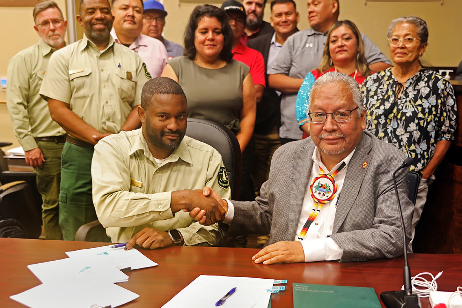
Settlement of Wild Horse Fire Brigade v. U. S. Bureau of Land Management (D. D.C.)

On July 19, the U.S. Department of Justice settled the lawsuit brought against the BLM involving the roundup of wild horses within and adjacent to the Pokegama Herd Management Area in southern Oregon.  BLM agreed to conduct an excess determination as required by the Free Roaming Wild Horse and Burro Act, and to follow NEPA procedures before continuing a roundup.  The article includes a link to the original complaint (and tells us more about their arguments).

(In yet another plot twist for the fire/fuels management debate: “the herd of wild horses owned and managed by local rancher/researchers (William Simpson & Michelle Gough) in conjunction with Wild Horse Fire Brigade, were instrumental in aiding CALFIRE during the deadly 2018 Klamathon Fire via wildfire fuels reductions prior to the onset of the wildfire, by creating and maintaining areas of reduced grass and brush fuels.”)

New lawsuit

In eastern Nevada, activists have sued the BLM after 21 horses died during a roundup in the Antelope Complex.

Notice of intent to sue

On July 19, the Center for Biological Diversity and Maricopa Audubon Society notified the U.S. Fish and Wildlife Service that the agency is in violation of the Endangered Species Act due to its unreasonable delay in proceeding with a proposed rule to revise the existing critical habitat designation for the endangered Mount Graham red squirrel.  Past logging of its habitat on the Coronado National Forest contributed to its listing, and Forest Service actions in its habitat have been challenged.  

Withdrawal of project litigated in Center for Biological Diversity v. Haaland (D. Nev.)

On July 20, two weeks after the lawsuit was filed, the BLM halted a proposed lithium mining operation near Ash Meadows National Wildlife Refuge over concerns that the drilling could impact the groundwater, the river it feeds and endangered and threatened species that depend on it.  Rover Metals will be required to submit a plan of operations with more information to BLM so the bureau can determine if it’s possible to mine without damaging the refuge or surrounding area.

Court decision in Rocky Mountain Wild, Inc. v. U. S. Bureau of Land Management (D. Colo.)

Plaintiffs alleged that, with regard to their 2019 FOIA request, “ongoing FOIA violations by Defendants have prejudiced RMW’s ability to fully participate in ongoing federal land management decisions, including the National Environmental Policy Act (“NEPA”) processes for the Tres Rios Resource Management Plan (“RMP”) Area of Critical Environmental Concern (“ACEC”) Amendment Process” specifically with regard to the Gunnison sage-grouse, and “under the heightened standard of the FOIA Improvement Act of 2016.”  In an earlier decision, the court required a more specific “Vaughn Index” documenting the nature and harm of documents withheld and redacted under the deliberative process exemption (Exemption 5), and required a more diligent search for records.  Unlike the Corps of Engineers case discussed here, this magistrate judge found on July 20 that, by adding additional context for the records, “The agency thus linked the harm to the specific information in the withheld documents.”  The use of “universal search terms” produced 803 more documents, and the court found it to be a “good faith effort.”  (However, the explanation for one of those documents did not measure up to those in the revised Vaughn Index and the court required its release.)

Court hearing in Oregon Wild v. U. S. Forest Service (D. Or.)

On July 21, the district court heard oral arguments in a lawsuit against three projects on the Fremont-Winema National Forest:  the South Warner, Bear Wallow and Baby Bear projects.  Plaintiffs object to the agency’s use of a categorical exclusion for timber stand and wildlife habitat improvement activities that would cover 29,000 acres, and assert that if CE-6 applied to this scale of effects, it would be invalid.  The article includes a link to the July 2022 complaint.

Settlement in Center for Biological Diversity v. Haaland (D. D.C.)

On July 24, the U. S. Fish and Wildlife Service agreed to dates by which it would complete 12-month findings regarding whether 33 species should be listed as threatened or endangered, most by the end of this year.  Two of the species are found in the southwestern U. S. and the rest in the southeast, and they include eight crayfish, six freshwater mussels, five cave beetles, four crustaceans, three fish, three salamanders, two plants, and two mammals.  The mammals are the eastern spotted skunk and the Texas kangaroo rat.  The press release includes a link to the settlement agreement.  (Presumably some of these are found on federal lands.)  This case is an offshoot of a 2019 notice of intent to sue over listing and critical habitat delays for 274 species.

Notice of intent to sue

On July 25, on behalf of Defenders of Wildlife, the Center for Biological Diversity, The Wilderness Society, MountainTrue, and the Sierra Club, the Southern Environmental Law Center notified the Forest Service and Fish and Wildlife Service of their intent to sue over the effects of the recently revised forest plan for the Nantahala-Pisgah National Forest on four threatened or endangered bat species and flaws in the required consultation process.  We discussed this here.  The news release includes a link to the notice.

Supreme Court decision in The Wilderness Society v. U. S. Forest Service

On July 27, the Supreme Court vacated the 4th Circuit’s decision to grant the Wilderness Society’s motions to stay construction on the Mountain Valley Pipeline pending that court’s possible review of the Forest Service’s amended forest plan for the Jefferson National Forest, and BLM’s approval of the pipeline permit.  The article includes links to the results from both courts (which provide no rationales).  This is only a decision about the stay, and the D.C. Circuit could still rule on the constitutional questions related to the Fiscal Responsibility Act legislation which purportedly authorized the pipeline to proceed.

New lawsuit:  Center for Biological Diversity v. Moore (D. Ariz.)

On July 28, the Center and Maricopa Audubon sued the Forest Service over its grazing practices on the Coronado National Forest, and the approval by the U. S. Fish and Wildlife Service of various grazing allotments.  Plaintiffs claim that failure to fence livestock out of riparian areas is harming the threatened Yellow-billed cuckoo and Sonora chub.  The news release includes a link to the complaint.

New lawsuit:  Albany County Conservancy v. Novotny (D. Wyo.)

On July 28, the Conservancy and a former Fish and Wildlife Service eagle biologist filed a lawsuit against BLM’s approval of a transmission line to connect the Rock Creek Wind project to two larger transmission lines that will export wind energy out of the state.  The lawsuit alleges that the approval was done without any public notification, comment or other forms of public participation required by NEPA, and that the EA is legally flawed, particularly the cumulative effects analysis of wind energy development on wildlife.  The article includes a link to the complaint and to a “Renewable Rejection Database,” which records 574 renewable energy proposals being blocked nationally since 2014.

In another article, the same author describes how, “The Bureau of Land Management is withholding oil and gas drilling permits on leased acres on public land, if the leased acres are in litigation.”

Notice of intent to sue

Columbia Riverkeeper, Idaho Rivers United, Idaho Conservation League and the Northwest Sportfishing Industry Association formally notified the Army Corps of Engineers on Friday that it intends to file a lawsuit against operation of four Snake River dams because they are primarily responsible for high water temperatures the effects on migrating salmon.  The potential plaintiffs argue that congressional authorizations for federal dams do not create exemptions to the Endangered Species Act and cannot prevent the dams from being prohibited and removed.

onX Access Efforts and Maine vs. Colorado Private Land Liability Laws

It seems like adding access to public lands is something everyone agrees on, unless I suppose, you are neighbors and there are undesirable effects of “bad apples”.  Or if you think more recreation means more negative environmental impacts.   Well, anyway.. turns out that onX (a company that has apps for hikers, off-roaders and hunters) also contributes to efforts to gain more access to public lands.

Here’s their philosophy:

A coalition of outdoor enthusiasts is stronger than divided groups. The various outdoor communities don’t always agree on how public lands should be managed. But the fact is, industrial development and suburban sprawl are larger threats to our ability to access public lands and waters, and every outdoor community is impacted, directly or indirectly. Efforts to preserve recreational access and keeping open land open will be more effective when outdoor enthusiasts work side-by-side, instead of focusing on our differences and fighting individual battles. By standing up for everyone’s right to access the outdoors, we’ll protect our own right to adventure.

I thought this about Maine was interesting.

Private Land, Public Access

This whole system is founded directly on Maine’s Landowner Liability Law, which is explained by the town of York, “If someone uses your land or passes through your premises for outdoor recreation or harvesting, you assume no responsibility and incur no liability for injuries to that person or that person’s property. You are protected whether or not you give permission to use the land.” This law has instilled good faith within landowners, primarily of large swaths such as timber company holdings, to allow recreational access of all kinds so that the general public can enjoy Maine’s treasured lands.

Well, why is land conservation so important right now in Maine if everything that isn’t posted is good to go? According to Maine Inland Fish and Wildlife, roughly 94% of the forested part of state is privately held. That means that most recreation that happens—whatever your vehicle, discipline, sport, or pastime—is likely going to happen on private land. When the state was mostly farmers and population density was low, that made it simple to know the neighbors across the stone wall. Now, increasing real estate sales, with smaller acreages, are resulting in a state increasingly segmented and, as previously mentioned, posted. This illustrates the importance that land trusts preserve public access, and keep the tradition alive.

In Colorado, we have something similar but perhaps not quite good enough as per this Colorado Sun story about 14ers..

Welcome to the woods. Please scan this code and swear you won’t sue.

After several months of closure, the Decalibron Loop trail accessing four 14ers in the Mosquito Range near Alma will reopen Friday to any hiker who scans and signs a liability waiver on their phones.

Landowner John Reiber is installing signs with a QR code on the road leading from Alma to Kite Lake, the starting point of the 7-mile Decalibron Loop trail that connects Mounts Democrat, Cameron, Lincoln and Bross. If hikers scan the code with their phones and e-sign the waiver, they will be able to legally access Reiber’s property along the Decalibron Loop. If they do not, they will be trespassing.

“This is not a true solution,” Reiber said. “This is a temporary Band-Aid to the problem. The true solution is for us to get the state law changed and fix the Colorado Recreational Use Statute. That is the ultimate fix not just for me but a lot of landowners.”

The owner of private property along the Decalibron Loop trail traversing 14ers in the Mosquito Range near Alma is opening his land to hikers who scan QR codes and sign a liability waiver. (Courtesy photo)

Reiber, who owns a patchwork of mining properties that lead to the summits of Mount Lincoln and Mount Democrat, is among a growing coalition of landowners worried they could be sued by recreational visitors on their land.

I wonder whether private land liability is an issue elsewhere?

“Quiet” Recreationists Have Impacts on Wildlife: Wyofile Story

From onX report here.

For our recreation readers:

Here’s a very interesting story, which, for me, had an unexpected twist near the end. Or even in the tagline.. “Researchers find as more humans play outside, a smaller proportion are engaged in stewardship that can protect the lands from growing impacts.”

A  black bear padding through the forest freezes. It looks up briefly, then something spurs it to turn and bolt in the other direction.

That something is the sound of hikers — a recording of women’s voices in conversation as they walk along a trail. It is emitted by one of many motion-triggered speakers scientists set up in the Bridger-Teton National Forest as part of a study on the impacts of outdoor recreation sounds on wildlife. And as this grainy game camera footage shows, even sounds that appear benign to us humans can disturb animals.

I wonder whether researchers need to put up signs that peoples’ conversations may be recorded?

It sets out to answer several questions, Zeller said, primarily: “Do mammals have increased stress or vigilance or other types of potentially negative behaviors when they hear recreation noise?”

They also want to know if birds avoid noisy areas, if animal communities change group behavior and what types of sounds are most impactful.

Ditmer and Zeller are only partway through data collection and haven’t quantified responses, but Zeller said they’ve seen many spooked animals — and one activity appears to be particularly startling.

“We’ve found that mountain biking with a large group size tended to result in a higher probability of wildlife fleeing a site compared with the other sound treatments,” Zeller said.

*******************

And yet, human hunters would also cause  increased stress or vigilance. If you’re curious about the interaction between ungulates’ vigilance toward hunters vs. wolves, there’s a study with red deer, wolves and hunters in Poland.

Those observations align with a 2016 study co-conducted by Courtney Larson, a Wyoming conservation scientist with The Nature Conservancy. Larson and her co-authors reviewed scientific literature regarding the impacts of non-motorized, non-consumptive recreation on wildlife. Some 93% of the nearly 300 studies that assessed recreation’s wildlife effects found at least one significant effect, most of which were negative, according to their findings.

Those effects can look like habitat fragmentation, or animals spending more time being vigilant and less time feeding, Larson said during a presentation in Laramie this spring. Awareness seems to be growing and people have good knowledge of times of year or places where wildlife are particularly vulnerable, she added. But questions remain on the varying sensitivity of species as well as how much recreation a landscape can hold.

*******************

Deteriorating experiences on public lands are on the rise, their study found. “So some of the biggest changes to our outdoor experiences are those caused by the very people that are enjoying the outdoors,” said Becky Marcelliano, onX stewardship marketing manager. Nearly two-thirds of the respondents cited overcrowding as negatively affecting their time in nature, for example. Outdoor recreation participation hit a record high nationwide in 2022, according to the 2023 participation trends report from Outdoor Industry Association.

​​Perhaps the biggest takeaway, she said, is a so-called “stewardship gap.” Though industry data shows 77% of outdoor enthusiasts make 12 or more outings a year, only 19% commit to a stewardship activity in that same timeframe, she said.

“Which means that less than one in five are doing the lion’s share of the work to protect and restore our public lands,” Marcelliano said.

At first I thought this was a little odd.   Can’t people just enjoy themselves, and feel glad that their taxes are supporting public lands? If they’re federal, state or county lands, shouldn’t employees and our taxes be doing “the lion’s share”?  On the other hand, people should behave as responsible human beings, including as they recreate outdoors.  Seems like rules, and enforcement thereof, have a place as well.

Anyway, onX considers these things stewardship.

Next post: onX and access.

Friday Wildfire Roundup


It’s summertime, so wildfire is in the news..

The Practice That Can’t be Named

The Southwest Fire Science Consortium will never get a Nobel (not “cool” enough to the Powers That Be) but they have won my award for Everything Science Should Be.. responsive to peoples’ concerns, integrated with practitioners, and gosh-danged helpful.

We had a serious  discussion last week on managed wildfire (or Muwoof, or Mafee?). Well it turns out that NAU, SWFSC and Forest Stewards did a science synthesis paper on this topic, what they call a science synthesis.  I am not enough of a fire person to understand all of it, so hopefully someone will read and chime in.

It’s not too often that I get a “laugh out loud” moment in the stuff I read, but the discussion about what term to use.. struck me as pretty funny. Yes, if you want to study something, a definition might be helpful. 🙂

Unfortunately, until the wildfire community settles on a shared lexicon, it will be difficult to track, measure, and understand managed wildfires. Various wildfire incident databases refer to the strategy using different names throughout time, making comparison difficult (Young et al. 2020). Even communication between land managers can become clouded because of differing terminology (Davis et al. 2022).

The “History of Wildland Fire Response and Nomenclature” is pretty interesting and begins on page 2.

Cerro Pelado Fire Was Started by a Burn Pile- Why Did it Take So Long to Figure This Out?

* (Thanks to Sarah Hyden) The Forest Service admits to another pile burn as the start of the Cerro Pelado fire.

Gov. Michelle Lujan Grisham sharply criticized the federal agency in a response Monday afternoon.

“I am — again — outraged over the U.S. Forest Service’s negligence that caused this destruction,” she said in a statement. “We will continue to to hold the federal government accountable for each of the disastrous fires they caused in our state last summer.”

U.S. Sen. Martin Heinrich, D-N.M., released a statement saying: “It is frustrating and deeply concerning to learn now that the Cerro Pelado Fire was also caused by an escaped prescribed fire.

“The warming climate is making our forests more vulnerable to catastrophic wildfires. That’s a reality that our Forest Service can and must urgently respond to when deciding when and how to do prescribed burns. We cannot catch up to this reality if it takes nearly a year to even make the findings on the Cerro Pelado Fire public,” Heinrich said.

“As the Forest Service does the necessary work of updating its modeling and use of prescribed fires, it must also prioritize rebuilding the public’s trust,” Heinrich added. “This will require more transparency and much more concerted and authentic engagement with New Mexicans than the Forest Service has shown up to this point.”

State Energy, Minerals and Natural Resources Department Cabinet Secretary Sarah Cottrell Propst said in a statement that agency’s failure to promptly disclose the fire’s cause, further harmed “New Mexicans who have been unable to file insurance claims pending disclosures of the fire’s origins.”

******************

Despite being covered by wet snow, this holdover fire remained dormant for considerable time with no visible sign of smoke or heat,” said Martin, in the statement released Monday.

I had a thought.. with all the high technology and defense contractors being funded, e.g. Invidia and Lockheed Martin teaming up to use AI and “real-time sensor data”, seems like a low-hanging fruit would be to put sensors in pile burns left over the winter or maybe fly heat-sensing drones over them, or some other sophisticated, repurposed from the military technology?

FEMA has so far paid out less than 1% of what Congress allocated for victims of NM wildfireFrom Source NM.

Good story. If you want a reaction, try The Hotshot Wakeup wondering why FEMA can’t get its act together.

and yet (also from the Hotshot Wakeup) the DOL is capable of doing its job.

***************
DOL (Department of Labor) Investigation of Federal Contractor Violation of Wage Laws

We oldsters won’t be surprised that some federal contractors weren’t paying people correctly. From DOL press release:

As a result of its investigation, the division recovered $152,003 in overtime wages and fringe benefits, as well as an additional $12,577 in liquidated damages for the affected workers. Back wages recovered ranged from $101 to $14,783 per worker. In addition, the company paid $16,981 in civil money penalties assessed by the department for the employer’s violations.

Hotshot Wakeup podcast this week explored both the above stories in detail, and suggested that $17K is not much of a penalty for trying to sleaze out on $152 K for employees.

***********************

Hotshot Wakeup also pointed out, in the same podcast, some of the close ties between the fire aviation industry and defense efforts of the less upfront kind.  My sources tell me that NSC is involved in all wildfire topics (going back to the FOIA from earlier this week).  So there are ties that aren’t obvious to those of us outside the industry. Which circles back to the issue of “what tech can watch pile burns?”

Recent Endangered Species Act policy news – June/July 2023

A Louisiana pine snake, a threatened species under the Endangered Species Act, in the Kisatchie National Forest, La. Gerald Herbert/AP Photo

REGULATIONS

On June 22, the Fish and Wildlife Service and National Marine Fisheries Service proposed (for public comment by August 23) a new set of regulations for administering the Endangered Species Act, which for the most part cancelled many of the changes adopted by the Trump Administration.  This follows litigation that resulted in the Trump rules being kept in place pending this action by the Biden Administration.  The changes are in three rules governing these main topics:

  • Interagency consultations under ESA section 7, including clarifying the distinction between the environmental baseline and effects of the action
  • Procedures and criteria for listing, reclassifying, delisting, and designating critical habitat for species under ESA section 4, including loosening criteria for designating unoccupied habitat, validating the role of long-term effects such as climate change, and removing economic considerations from this scientific process
  • Reinstatement of USFWS’s blanket ESA section 4(d) rule which, prior to its repeal in 2019, extended the take prohibitions of ESA section 9 to all species. listed as threatened under the statute unless USFWS issued a species-specific rule

While those who liked the Trump version would be expected to criticize all of this, the conservation organizations are not entirely happy that some of the Trump changes have been retained.  A couple of key ones noted by the Sierra Club include:

“One such regulation severely undercuts critical habitat protections. The policy says a development project must affect critical habitat “as a whole” before alternative projects are considered. This would protect a species with a small range because a major infrastructure project would likely destroy its entire area, and thus it would be hard to approve such development. Not so for species with large ranges, like northern spotted owls and gray wolves. There would never be an instance where habitat was destroyed as a whole for a species whose range includes hundreds, thousands, or even millions of acres.”

“Another missed opportunity, conservationists say, was the chance to update the definition of “environmental baseline,” a term used to describe the habitat of a listed species before federal agencies begin a project. Agencies are supposed to evaluate whether their activities jeopardize a species’ survival and recovery. The Biden administration decided to keep the 2019 rule that allows officials to overlook the cumulative effects of past decisions for ongoing projects. Dams in the Pacific Northwest, for example, have pushed salmon and trout runs to the brink of extinction. When a federal agency is looking to extend a dam’s operating license or approve a new dam operating plan, its consultation with the wildlife agency shouldn’t ignore those past effects on the species’ biological condition.” (For land management agencies, this might apply to something like roads.)

On July 3, the Fish and Wildlife Service adopted a final section 10(j) rule that would allow it to establish experimental populations of endangered species in places outside of their normal historical range.  This is primarily in response to changes in species’ habitat resulting from climate change:

“Through this rule change we are adjusting our regulatory authority to allow us to adequately respond to these potential scenarios in circumstances where it may not be possible to recover a species within its historical range because of loss or alteration of some or all its suitable habitat,”

LITIGATION

Court decision in Maine Lobstermen’s Association v. National Marine Fishery Service (D.C. Cir.)

On June 16, the circuit court reversed a district court decision and invalidated a regulation issued by the National Marine Fisheries Service to protect Atlantic right whales from lobster and crab fishing activities.  The case is viewed as significant because it discusses and dismisses the use of the “precautionary principle” where there is scientific uncertainty under the Endangered Species Act.

NMFS consulted with itself on the regulation to determine if jeopardy would be likely.  In its Biological Opinion, NMFS concluded that federal fisheries entangle more than 9% of right whales each year.  According to the court, to reach this estimate, the Service put aside the data on confirmed entanglements and relied instead upon a “scarring analysis” from a 2019 study, noting “This approach provides the benefit of the doubt to the species and a more conservative estimate of total right whale entanglements.” NMFS stated that “uncertainty is resolved in favor of the species” and that it generally “select[s] the value that would lead to conclusions of higher, rather than lower, risk to the endangered species.” To defend its use of the worst-case assumptions, the agency pointed to a line in a House Conference Report for the 1979 amendments to Section 7 of the ESA, which stated that “this language continues to give the benefit of the doubt to the species.”  In its consulting role, NMFS concluded that the regulation would not jeopardize the species.  In adopting the regulation, NMFS acknowledged that its “model outputs very likely overestimate the likelihood of a declining population.”

The court declined to give deference to the agency, and held the BiOp was arbitrary because in the administrative record NMFS had erroneously claimed that its position was required by the ESA’s legislative history, and because its current “policy” on resolving uncertainty using the precautionary principle conflicted with its prior (opposite, under the Trump Administration) position.  In addition, the court stated:

“Statutory text and structure do not authorize the Service to “generally select the value that would lead to conclusions of higher, rather than lower, risk to endangered or threatened species” whenever it faces a plausible range of values or competing analytical approaches. The statute is focused upon “likely” outcomes, not worst-case scenarios. It requires the Service to use the best available scientific data, not the most pessimistic…

If brute uncertainty does make it impossible for the Service to make a reasoned prediction, however, the interpretive rules supply a ready answer: The Service lacks a clear and substantial basis for predicting an effect is reasonably certain to occur, and so, the effect must be disregarded in evaluating the agency action.”

However, the court left the regulation in place, concluding that NMFS might be able to justify it on remand.  (Perhaps meaning, “if they say it in a different way.”  It may also be possible for the consulting agencies to interpret a study that uses the precautionary principle as the best available science for predicting likely outcomes.)  Here is another summary of the case.

“Greenwire,” in its “occasional series” discusses the role of litigation in implementing the Endangered Species Act.  Some highlights:

During President Ronald Reagan’s first three years, 22 species were listed as threatened or endangered. By contrast, 100 species got protections in the Carter administration’s first three years.  In response, a frustrated Congress in 1982 amended the law to add deadline teeth.

A 2017 Government Accountability Office study found that plaintiffs filed 141 such ESA missed-deadline suits between fiscal 2005 and 2015.

“The Fish and Wildlife Service knows the workload, and it refuses to ask for enough money to get the work done,” Suckling (Center for Biological Diversity) said, “and then when it doesn’t get the work done, it goes to the judge and says, ‘Your Honor, I don’t have enough money.’”

“Of our total revenue in a given year, only about 5 percent comes from legal returns,” Suckling said. “It’s really just not that much money, [and] settlements are good for everybody.”

“We could avoid having to fully litigate cases and use scarce resources to do so if the agency would agree to settle cases more,” said Larris of WildEarth Guardians, “but they much more often decline to settle.”

In what’s still one of the most comprehensive studies of its kind, Biber and co-author Berry Brosi, a biologist now at the University of Washington, assessed the role played by petitions and litigation with hundreds of species. They concluded, in a 2010 issue of the UCLA Law Review, that species listed as a result of a petition or litigation faced greater threats than species listed on the agency’s initiative.  Biber said he believes the 2010 conclusions remain valid, saying that overall, petitions and litigation “are beneficial [in] ensuring that the species most at threat are protected.”

Former FWS Director Dan Ashe, who oversaw the agency during the Obama administration and now is the president and CEO of the Association of Zoos and Aquariums, assessed that “litigation overall has been beneficial” in sustaining a focus on protecting species.


Surprise! Not: Lawsuit Filed on Pisgah-Nantahala Plan and the Prophetic Andy Stahl

Normally, this is Jon’s area,  but I thought that this is an interesting example.. just on the forest planning side.  Apparently forest planning has been going on since 2014 (for almost 10 years) to make a 15 year plan.. which should be a “30 year plan” according to this article.  And of course, there will be many changes in those  years from climate and other factors, and hopefully the plan will be flexible enough to adapt to these new situations or be easily amended.

In the notice of the lawsuit, filed Wednesday, lawyers for the Southern Environmental Law Center say the forest is home to 28 federally listed endangered and threatened species, as well as 29 other species that are candidates for that recognition. Many of those species have declined dramatically over past decades and require more stringent protection than the final forest plan offers them.

“For example, the northern long-eared bat, which relies on mature forested habitat in the [forests], has declined by more than 90% over the past few decades,” attorneys for the SELC said in the notice. “These declines should not be secondary considerations, subordinated to timber or game wildlife management. Instead, reversing these declines is central to the Forest Service’s mission.”

The filing also alleges that the Forest Service years ago provided incomplete or incorrect information to the U.S. Fish and Wildlife Service, which subsequently issued an official opinion that the additional logging planned would have little impact on the listed species.

“We cannot sit back while this irresponsible forest plan ignores the science, breaks the law, and puts these remarkable species at risk.” Sam Evans, leader of SELC’s National Forests and Parks Program, said in a news release. “Forest plans are revised only every 20 years or so, and our endangered bats won’t last that long unless we get this plan right.”

I am reminded of a prophetic statement by Andy Stahl here on The Smokey Wire in 2011.

The big difference between the old (1982) rule and the new proposal is that the new eschews any pretense of “rational” economic planning. The old rule regarded the national forests as factories of goods and services from which planners could divine, with the help of linear programming models, an optimum allocation and schedule of harvests. Each output was assigned a value; each input was assigned a cost. When the model didn’t give the desired answer, planners tweaked the numbers. When the tweaks didn’t work, planners made-up the numbers.

The edifice came crashing down in the late 1980s. A quarter-century later, the Forest Service is still digging itself out from under the rubble.

The new rule replaces economic rationality with ecological rationality. The old gurus (e.g., Krutilla, Hyde, Clawson and Teeguarden) have been deposed by Soule, Ehrlich, MacArthur and Wilson. Leopold is the new God (is it coincidence that the Forest Service released this month a new Leopold biopic?); Pinchot is history.

Perhaps ecologically rational planning will be more successful. But I doubt it. The new forest planning process still pits bitter ideological enemies against each other with the Forest Service serving as self-interested arbiter. The modern-day critic will turn from deconstructing FORPLAN to deciphering HexSim. Every plan will be appealed and most will be litigated.

Perhaps in another quarter-century the FS will abandon any pretense of rational comprehensive planning and consider the incremental, on-the-ground K.I.S.S. approach I suggested. I should live so long.

Andy’s comment was in a post on Pete Nelson’s views on the wildlife provision, posted by our old friend Martin Nie.  And now Pete has been hired by the Forest Service to help with policy options for MOG..  and folks are writing in about needing Martin’s specific triggers determined beforehand based on monitoring, and the Forest Service circle of planning to plan continues…

Personally the biggest problem I see is the tension between “with climate unknown emergencies could arise at any time, forests will burn up and or convert to grasslands or brushfields and management will need to be flexible with these unforeseen futures” and “we need planning that’s based on ideas from the past (reference conditions) and is highly structured with many many sideboards. ” Maybe the conversation we need to have is… why don’t you trust federal employees to make the right conservation decisions in the moment? Can we have both, flexibility and trust, without lengthy and protracted exercises that are just another opportunity for “ideological enemies” as Andy says, to attempt to renegotiate previous agreements?