The 2022 Cedar Creek Fire & The 1897 Organic Act (Part 1)

This is the second article in a two-part series regarding fire management by the US Forest Service near the towns of Oakridge and Westfir, Oregon. The first article focused on forest restoration and prescribed burning on Jim’s Creek, in the Willamette National Forest, and was linked and discussed here: https://forestpolicypub.com/2024/11/01/jims-creek-restoration-a-burning-opportunity/

This second article is 3500 words, has eight photos. a map, and a detailed table, so I’m going to post in two parts: the timeline and extent — with opinions — on the 2022 Cedar Creek Fire; and the health and economic impacts of the fire on local communities as compared to historical Forest Service responsibilities — with recommendations. Both articles are part of a 13-year series I have been writing for Oregon Fish & Wildlife Journal, and this current article can be found here:   http://nwmapsco.com/ZybachB/Articles/Magazines/Oregon_Fish_&_Wildlife_Journal/20250108_Cedar_Creek/Zybach_20250108.pdf

Fig. 1. Cedar Creek Fire Smoke Plume, September 9, 2022. Plume is from the west side of Maiden Peak, viewed from the south end of Davis Lake about 4:00 PM. Foreground snags are mostly ponderosa pine from the 2003 Davis Fire, which burned 23,000 acres. Some salvage logging had taken place but was stopped by litigation. Reproduction is mostly ponderosa and lodgepole pine, with some Douglas fir, which may have been planted among the natural seeding. Plume is blowing toward Bend. Photo by Rob DeHarpport.

The 2022 Cedar Creek Fire in Lane County and the Willamette National Forest in western Oregon, burned 127,311 acres. This number included 11,709 acres of so-called “critical habitat” (which the Forest Service calls “CH”) for spotted owls (“NSO”), as defined by college professors (PhDs), litigation (EAJA), and the Endangered Species Act (ESA).

Local towns of Oakridge and Westfir were severely threatened by the wildfire, were blanketed with unhealthy smoke for nearly six weeks, and forced to evacuate entirely for four days while power was shut down.

This didn’t need to happen. The wildfire was said to have been poorly managed by the Forest Service (“USFS”) for an entire month before predictably exploding on an east wind in early September. By the time it was fully extinguished on November 22, taxpayers had spent more than 132 million dollars to employ more than 2500 firefighters that had operated dozens of helicopters and heavy equipment for the previous three months..

I visited the Cedar Creek Burn a few months ago with three friends to view the results of two years of Forest Service projects following the fire. We had to get a special permit to pass a locked gate that was installed to keep the public away from the site. That seemed to be it: approximately two billion-plus feet of standing timber, rotting in place, primed to burn again — only much hotter next time — no apparent response, and the public is locked out.

The November, 2022 USFS BAER (“Burned Area Emergency Response”) report doesn’t mention the obviously increased risk of deadly wildfire, but states instead that: “Threats include additional loss of habitat in the fire area due to blowdown, mass soil movement, flooding, and insects and disease.” But not wildfire?

Further: “A secondary issue includes determination if the proposed BAER stabilization treatments could affect spotted owl nest sites or result in disruption of nesting if conducted during the critical breeding season from March 1-July 15.”

Say what?  More than 125,00 acres of trees are dead, nearly 12,000 acres of so-called “CH” has been destroyed, and yet the government can’t do anything about it for half the year because of SWO “critical breeding season?” How can this be written, reviewed, and publicly distributed, much less taken seriously?

Speaking in metrics and acronyms and producing voluminous busy-work reports seems to be the effective strategy. Also, the apparent NSO CH “critical breeding period” has apparently now been extended to the entire year, as there was no evidence at all of either USFS or spotted owl occupation at that time — just a locked gate.

Cedar Creek Fire Timeline

The Cedar Creek Fire started by lightning strikes on August 1, 2022, on the Willamette National Forest, about 15 miles east of the towns of Oakridge and Westfir. According to the BAER report, it couldn’t be extinguished as it “grew rapidly” in “inaccessible terrain,” and then was “held at control features for around one month” until the east winds arrived — as generally expected — in early September.

It is currently unknown why smokejumpers weren’t sent to extinguish the fire, but a helicopter with two “rappelers” flew over at 4:45 PM and reported it was about two acres in size and “burning in heavy timber midway up a 40% slope on a significant cliff with limited options for egress.”

At that point the rappelers turned down the assignment, reporting the terrain was “too hazardous for safe access.” Instead, a plan was developed to hike firefighters into the fire “during the next shift,” while helicopters performed bucket drops to limit its growth. The fire was estimated to be about five acres on August 2 and grew to an estimated 500 acres on August 3.

 By August 15, the fire had grown to 4,422 acres with 0% containment. All recreational trailheads and dispersed camping were closed both west and north of Waldo Lake. The following day, August 16, the Forest Service posted this statement, along with a three-minute video on its new Facebook public information page:

“Since it started on August 1st, the Cedar Creek Fire has been slowly getting bigger, moving east into wilderness and roadless areas, and south towards the bottom of Cedar and Black Creeks. Hundreds of firefighters have been deployed around the fire, creating primary and backup firelines. This effort is guided by a strategic planning process that combines the latest fire science with on-the ground observations and years of firefighting experience. To learn more about the strategic planning process and why it is being used at Cedar Creek, watch this short video.”

Fig. 2. “Nature’s Clearcut.” View of increasing risk of wildfire the longer these snags remain in place. What had been large, growing plants filled with water were transformed in minutes by fire into massive amounts of pitchy, air-dried firewood. Unless something is done with these dead trees, the next fire through here — as with all predictable Douglas fir reburns — will be much hotter and cause more widespread damage than this fire. When snags fall before they reburn, they can also cause far  more damage to the soil. Mark Cosby and Rob DeHarpport provide scale. Photo by author, October 28, 2024.

On August 27, the fire had grown to 7,632 acres with 0% containment. The “strategic planning process” involved possibly the very first use of USFS “PODs”:

“The District identified a contingency line based on a fuels assessment known as PODs (Potential Operational Delineations) well west of the incident. This line would provide a reliable fuel break in the event of a major east wind as well as any future fires that may threaten the communities of Oakridge and Westfir. While fire modeling and seasonality during the early stages of the incident did not indicate a strong likelihood that this line would be utilized, all the teams assigned continued to work on this contingency option.”

On September 4 the fire began burning through the 1996 10,400-acre Charlton Burn in the Wilderness along the north side of Waldo Lake. The fire had never been salvaged or treated and was covered with fallen snags that burned very hot and sterilized the soil in much of the area.

By September 8, the fire had grown from 27,000 acres and reached over 73,000 acres according to news sources — however, the government reported an increase to only 33,000 acres, and growing to 52,000 acres on September 10.

On September 9, the USFS official online information source for wildfires, “InciWeb,” reported the “Current Situation” as: “East winds, low humidities, and high temperatures will cause the fire to be active today. The highest activity will occur where lichen is present in trees and there is a high concentration of down wood. Where winds align with slopes, tree canopy fire and fire spotting are anticipated. E winds 15-20; gusts to 50.”

Given this report, the Lane County Sherriff’s Department made the decision to move Oakridge and Westfir into a “Level 3” evacuation, where residents are asked to leave by a given time and access roads are typically blocked. Powerlines were “de-energized” throughout the wind event and the duration of the evacuations, which were ordered for the following day.

Smoke from the fire moved into southwest Washington on September 10, and Seattle recorded the worst air quality of any major city in the world, with Portland coming in third out of the top 90, and Lahore, Pakistan sandwiched between the two. Seattle’s “AQI” was 170 and Portland’s was 152 (more on this later).

Fig 3. Blair Lake. This was a popular recreation spot for fishing and boating before the Cedar Creek Fire. It is now gated off from the public and surrounded by dead trees. In earlier times the lake would have formed a natural firebreak, and it is unlikely that the large amount of second-growth trees that crowned would have been present in such large numbers. A few trees that survived the fire might be good as a seed source for future reforestation efforts. No information on reopening. Photo by author, October 28, 2024.

Sometime at this point the fire began burning into the infamous 1991 Warner Creek Fire scar, which had made national news for several years due to threatened legal actions and active anti-logging protests by “concerned environmentalists.”

The 8,973-acre fire had cost $10 million to control and killed an estimated 180 million board feet (mmbf) of timber. Of this amount, only 35 mmbf were scheduled for sale, but two years of protests reduced that number to nine mmbf. Five years of protests and litigation later, no salvage had been completed, and the proposed sales number became only two mmbf. Then, 540,000 board feet were finally sold, and then the sale canceled. In September 2022, it all burned up.

By September 11 the fire had grown to 86,000 acres, more than 2,000 homes had been evacuated, and all highway access to the towns was blocked. Two days later the power was restored, and residents were allowed to return to their homes.

On September 12 the wind had shifted to the northwest and smoke began affecting air quality in Sisters and Bend, while clearing the air in Oakridge for a few days.

Fig. 4. Spring Prairie. There are numerous oak trees, huckleberry patches, and beargrass meadows in the Willamette National Forest in the vicinity of Oakridge. These are strong indications the land was regularly occupied and burned by Molalla and Klamath people during early historical time — and likely for many generations before. Several of the surviving trees around the prairie’s perimeter might be good seed sources for future reforestation efforts. Photo by author, October 28, 2024.

On September 16, the Central Oregon Daily News reported the fire had grown to 92,596 acres and videotaped Joan Kluwe, the “Public Information Officer for the Alaska Incident Management Team,” saying: “We have 92 engines, 39 crews, 113 types of heavy equipment, and 19 helicopters working on the fire.”

The total cost to “fight the fire, maintain and operate the machinery and take care of the personnel” to that date was given as $57,946,000.

On September 25, the fire had grown to 114,104 acres with 20% containment.

By October 27, the fire was 127,283 acres with 60% containment. Due to seasonal dropping temperatures and rising humidity, fire progression had nearly stopped, and the workforce had been reduced to two crews, one helicopter, two masticators. and four engines.

The following day, Fall rains and snow began, and finally, on November 22, the Cedar Creek Fire was declared “out.”
NEXT: Part 2.

Phil Aune: Our Forest Legacy

A few months ago I posted about the ongoing and informal National Wildfire Institute (NWI) and its current efforts in context to its past history: https://forestpolicypub.com/2024/10/02/burned-out-us-forest-service-is-destroying-our-western-towns/

One of these efforts is the “National Wildfire Emergency” project envisioned and spearheaded by Lake Tahoe writer, Dana Tibbitts, whose current and former homes have been subjected to evacuations, wildfire threats, and deadly smoke pollution several times in the current and recent years.

A cornerstone to this effort has been three recorded Zoom meetings with 16 prepared statements by 14 participants — including a dozen national and regional experts on wildfire management and forest restoration. I have been working with Dana and Nadine Bailey and Luke Van Mol by developing transcriptions of the various statements in order to better document these events and contribute to the video editing process.

One of the experts contributing to this project is Phil Aune. His statements are very much in accordance with recent discussions on this blog regarding the abrupt departure from proven reforestation methods and research by the US Forest Service and others in the 1980s:

********************************

My name is Phil Aune. I have a 50-year career in the forestry arena — 37 years with the U.S. Forest Service, and with my last assignment as 13 years as a research program manager. After that I served six years as Vice-President of the California Forestry Association, and since I flunked retirement after we moved to Spokane, Washington, I went to work as a consultant for the American Forest Resource Council.

We’ve lived in Spokane, Washington for the last 20 years, but I constantly go back to California [to] see my grandchildren, and on the way I usually take time to look at some of the wildfires. It’s easy to see —  they’re everywhere.

I’m also on the Board of Directors of the Evergreen Foundation, that’s Jim’s [Petersen] foundation, and I’m also a member of the Board of Directors of the National Museum of Forest Service History.

What I’m here to talk about today is what I call “the legacy.” The legacy of wildfires. And I’m primarily talking about Oregon, Washington, and California, where I have some experience. I also see it in Idaho and Montana, in my travels around those States.

The first point I see is the vast majority of the dead trees are not being salvaged. The first legacy that we’re going to see is thousands and thousands of acres of black, standing trees, as long as they’re standing for the next 20 to 30 years.

Meanwhile, trees will ultimately die and fall to the ground and become fuel for the inevitable next wildfire, making it even more difficult to control and, more importantly, all that fuel will now be on the surface, and that surface fuels will concentrate the heat on the upper end of the soil profile, severely damaging the soil.

So it’s a long-term productivity effect that no one has really researched extensively — to follow up exactly what’s happening to these wildfires, especially the reburns that have occurred in wildfire areas.

Very little of the ground in the legacy is being reforested, and we’re developing a huge reforestation backlog. Keep in mind that in 1976, in a National Forest Management Act portion, Congress dictated us — to the Forest Service — to develop the reforestation background.

And here’s what the National Forest Management Act said, in Section 4 (d)(1): “It is the policy of Congress that all forested lands in the National Forest system shall be maintained in appropriate forest cover . . .”

“Shall be maintained in appropriate forest cover!” Where in the heck is that going on?

“. . . with the species of tree, degree of stocking, rate of growth, and conditions of stands designated to secure the maximum benefits for multiple use and stained yield concepts in the land management, according to the land management plans.”

So why aren’t they reforesting these lands? That’s a big question.

Congress even developed the funding mechanism necessary to reforest all the lands in the backlog. It was called R and I Fund: “Reforestation and Stand Improvement.” The money came from offshore oil receipts. It wasn’t even a problem in getting the funds — and if we start looking at our resources in total, we can expand our oil production, expand our revenues from that. It all works together to making life easier for everyone.

The real reforestation backlog that was declared in 1976 has grown substantially. And if you look at the last 20 years, that’s where the bulk of the backlog is growing.

Well, what’s going to happen to all of these lands?

The lands that are not actively reforested will change into brush and hardwood communities for the next 75 to 100 years. Yes, they will naturally regenerate, but how much time do you have? How much time do our children have?How much time do our grandchildren, our great grandchildren? This is a real issue. We’re leaving black forest and brush fields in what once was magnificent conifer forest . . . that’s the condition that our grandchildren will receive.

Next point I’d like to make is we don’t have to do that. We have the knowledge and skills from science-based reforestation. And I can speak personally from that, as a research program manager whose mission was to look at the entire reforestation cycle for the last . . . 13 years of my career — plus the practical experience I had during the time Iwas in active management.

The Forest Service has this background, and it includes the following necessary steps:

Collection and storage of the seeds — the cones and the seeds that we’re going to need to reforest the land. It’s a no-brainer. We have to establish nurseries to grow these seedlings. We don’t have to have bare-root nurseries. We can go with container nurseries. But the Forest Service has to start expanding if they’re ever going to get back on top of thereforestation backlog.

Here’s probably the most critical point: you need prompt salvage of the wildfires. Roger [Jaegel] spoke about that at length. That what’s happening — if you don’t salvage them, those trees are still going to be there, and they’re fuel. And then, from a common-sense point of view: does it make sense to cut green trees when you got thousands and thousands of dead trees to cut that are still utilizable?

We need to do proper site preparation. We’ve got to have planting crews available. It’s a temporary work job, and we definitely need to provide for common-sense planting crews and have that workforce available.

The biggest point we have to do is prepare to reduce plant competition after planting because, as we live in most of the California, Oregon, and Washington, in the dry Mediterranean type of environments, the seedlings have to survive with the moisture that’s left in the soil, and unless you control the grass and the brush — competing plants — all of your planting efforts will be for nil, as many, many of the trees die. I’ve investigated thousands of acres of dead seedlings, and the biggest factor that you find after planting, and you go look at why they die, is we didn’t control plant competition.

Reforestation is a commitment to all of these processes — and just as much as not reforesting is a commitment to understanding and recognizing that it’s going to take centuries for all these forests to eventually regenerate naturally.

Joe [Reddan] mentioned the Organic Act of 1897. When Congress [passed the Act, it had as] one of the key purposes to provide for the protection and maintenance of our National Forests [ . . .]. How can we look the public in the eye and say: “we are providing for the protection and maintenance?”

The second major factor was: protect the headwaters of navigable streams. Where, on God’s Green Earth, have theyever protected the headwaters of navigable streams with using concepts like “managing wildfires for resourcebenefits,” which is just a euphemism for not fighting fires promptly.

The last one was that they — after they provide the protection and maintenance — the third purpose was to provide for continuous supply of timber for the citizens of the United States. Good luck on that one! Thank you very much.

Jim’s Creek Restoration: A Burning Opportunity

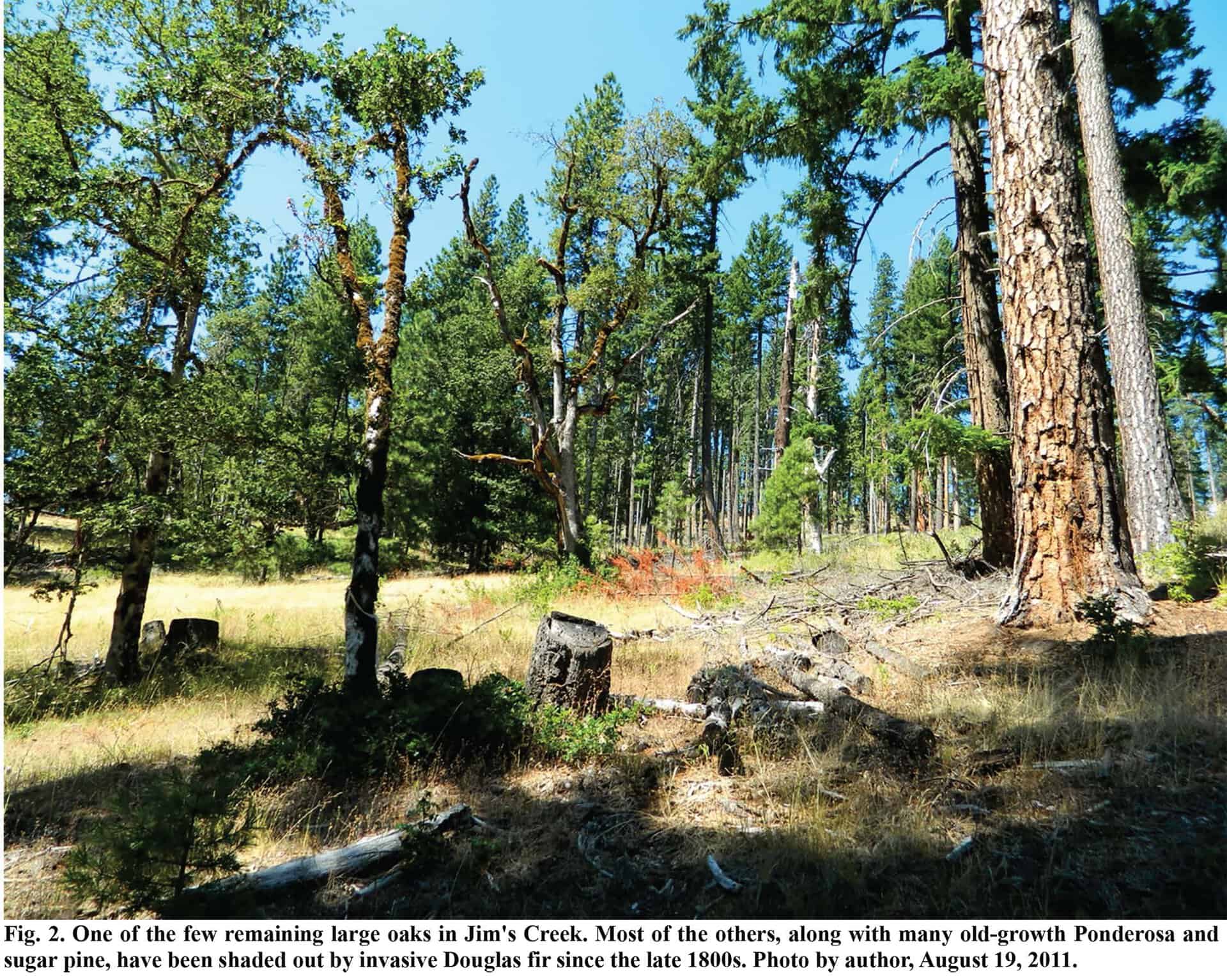
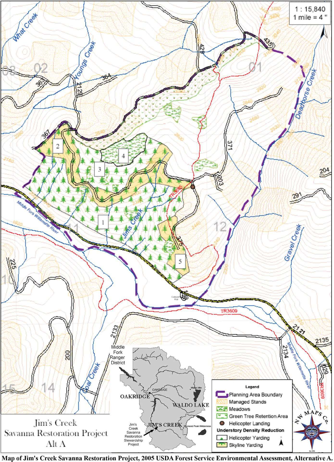
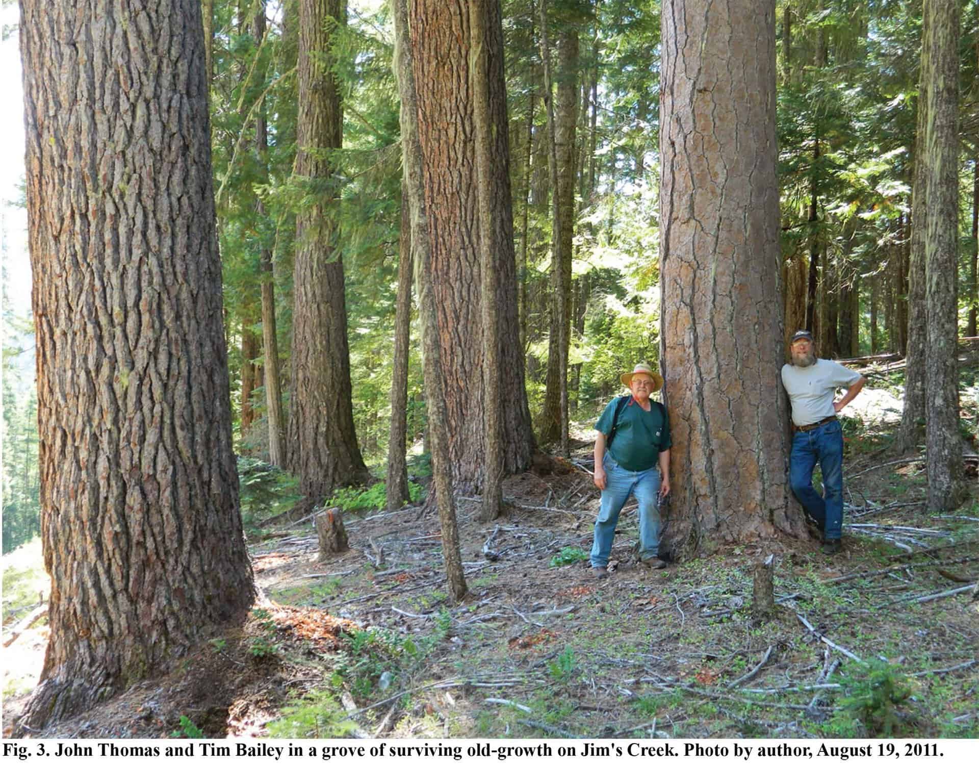
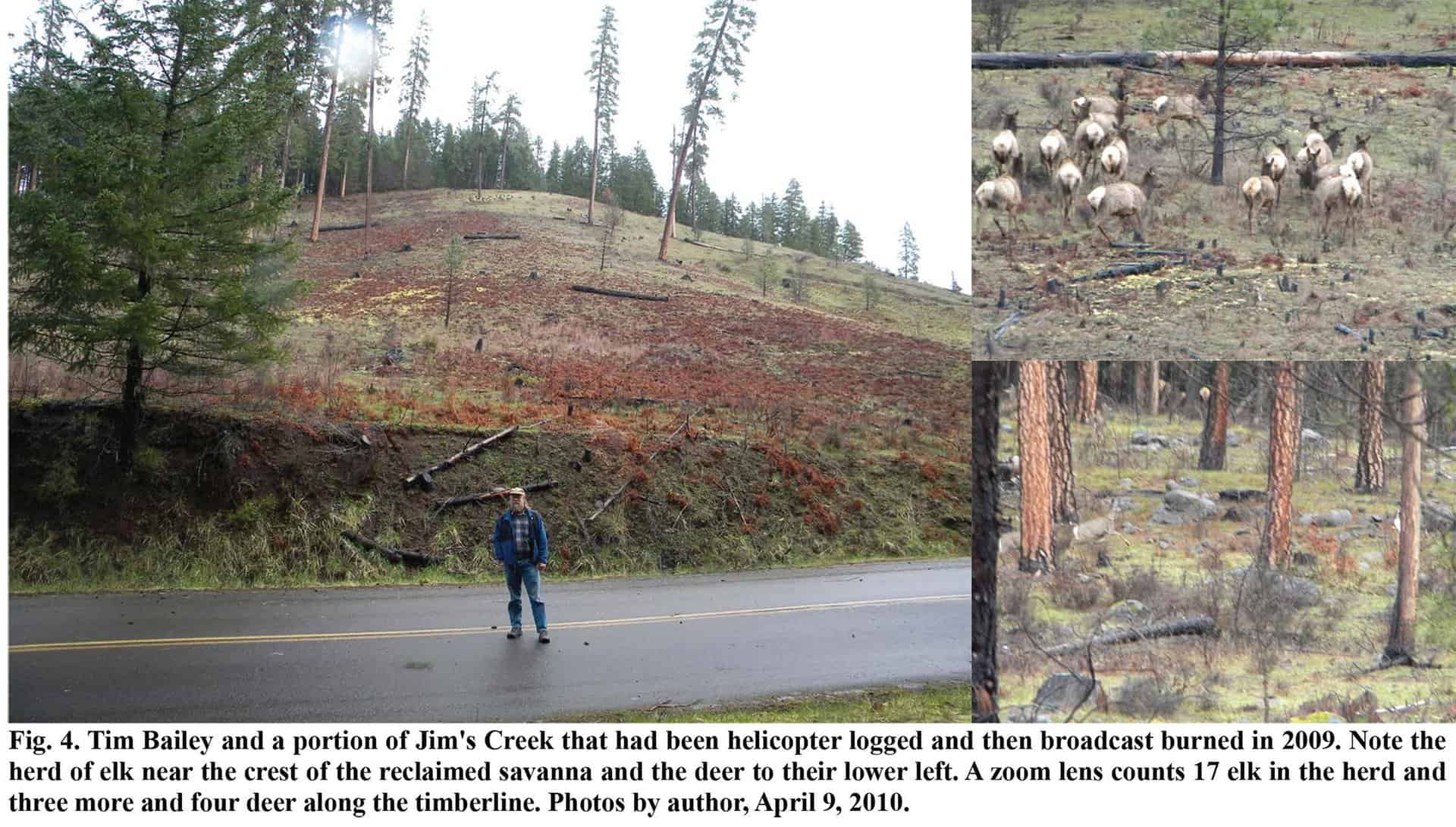
I have been writing about the oak and pine savanna project on Jim’s Creek for more than 10 years. This summer I revisited the site with its architect, Tim Bailey, who spent the majority of his career on The Willamette National Forest in Lane County, Oregon.

The following 10 figures, map, and captions are from my current article on Jim’s Creek, which illustrate and document the text: http://nwmapsco.com/ZybachB/Articles/Magazines/Oregon_Fish_&_Wildlife_Journal/20240918_Jims_Creek/Zybach_20240918.pdf

The text is 2700 words, but here are the concluding two paragraphs:

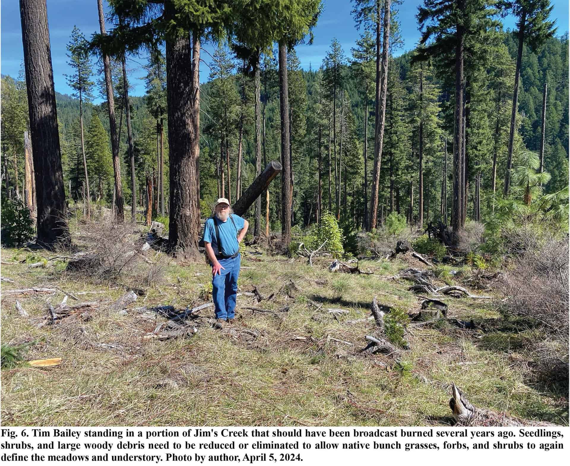
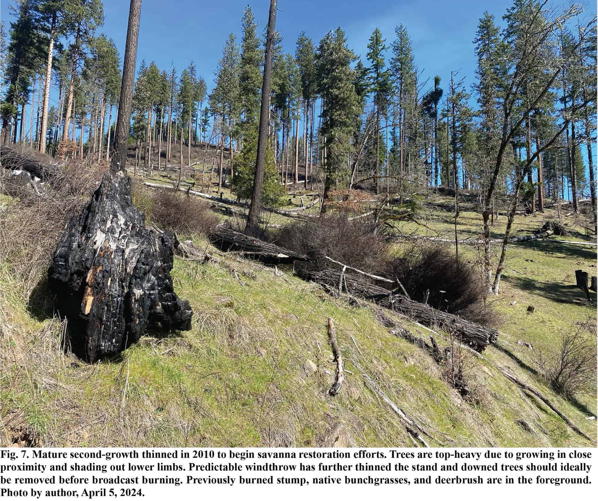
“Jim’s Creek needs to be completed. All 638 acres should have been burned 10 years ago, as planned and paid for. If people actually care about “critical habitat” and “biological diversity” — which are legal terms, not science — they should burn Jim’s Creek now, this fall, when the Molala would have burned it. If the Forest Service can’t do it, how about a local business, as in pre-spotted owl litigation times? Or the volunteer fire department? Prescribed fires are a lot cheaper and safer than wildfires, and this would be a great opportunity to publicly display that difference.

“Jim’s Creek has good road and stream boundaries, fuel preparation could be done in a few days time, and trained crews are available as wildfires are being extinguished. Late summer and fall burns, as people have done for thousands of years, would greatly reduce risk and severity of wildfires, and is the pattern that native plants and animals have both adapted to and thrived until now.”


Burned Out: US Forest Service Is Destroying Our Western Towns

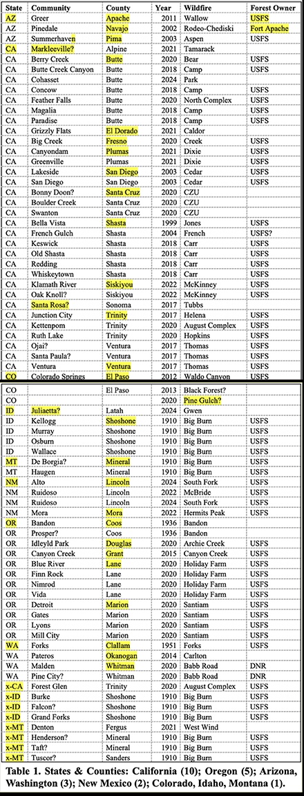
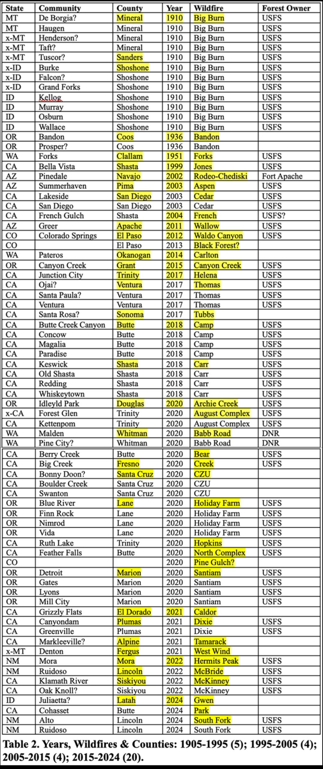
[This Post includes two JPEG Tables. Any one who can help correct, fill, and/or map this data would be very much appreciated.]

About 15 years ago, forester Bruce Courtwright became very concerned about increasing wildfires and wildfire risks to the communities of northern California, so he helped gather a number of other wildfire experts to collectively address the problem. This group eventually became known as the National Wildfire Institute (NWI) and was in the process of becoming more formal a few years ago, when Bruce became ill and died. Without a leader or formal organization, members have remained active, mostly via informal email discussions, local meetings, phone calls, and proposals. Promotions of Michael Rain’s “Call to Action” and Jim Petersen’s “First, Put Out the Fire!” have been key group efforts to effect needed change as to how the USFS can better manage its wildfires and forestlands — and including immediate snag salvage and site preparation moving forward, followed by better reforestation planning and forest maintenance strategies for future generations.

These efforts continue, and were recently expanded with Rob DeHarpport’s concern over the increasing number of rural towns being damaged or destroyed in forest fires. That insight has led to me, Petersen, Lake Tahoe writer Dana Tibbitts, and NWI members such as Roger Jaegel, Bill Derr, and Bill Dennison,  to begin assembling a list of affected communities in order to develop a baseline for further analysis. An Excel file was established for this purpose and our initial findings — summarized in the following two tables — were startling. So far, more than 70 communities are listed, beginning in 1905, most such fires have occurred in the past 10 years, and almost all of them were started on National Forests, and most of those are in the legal range of spotted owls and subjected to the NWFP.

Initially the listing started with the Peshtigo and Great Michigan forest fires of 1871, but from the outset the focus has been on towns most recently burned and rebuilding, and on towns currently threatened by wildfire risks on adjacent and nearby forestlands. There was no attempt to list towns or named communities that were subjected to grass or shrubland fires, or included rural subdivisions  or mobile home or RV parks — just forest fires, and an arbitrary division of at least 30 structures burned; or 50% of a community’s structures if it had less than 60 buildings. We were pretty shocked at how recent most of the fires were, and also that  they were almost entirely related to USFS lands, so we made 1905 the logical starting point. All indications are that the September 2020 Fires were at least as destructive, if not as deadly, as the historic 1871 and 1910 Fires.

Table 1 is a listing of the burned communities arranged by state and county. We fully expect these numbers to increase with midwest and south histories, as well as the 1963 Pine Barren Fires in New Jersey. The “x-” States are those showing towns that were burned and never rebuilt — the 1910 Railroad towns are most of these. The “?” Towns are those that may have escaped damage or weren’t related to a forest fire and may need to be removed. Any help with blanks, corrections, or additions appreciated!

We now know which counties to contact for elected officials, media, and long-time businesses and residents. The purpose would be for further study and public outreach for this unrecognized emergency of deadly town fires directly related to USFS forest and wildfire management policies.
The reason these numbers should be recognized as a national emergency is because of the massive increase in these events in the past 10 years, as shown on Table 2. From 1905-1995 — 90 years — we only have forest fires burning into towns in five counties (although this number is likely to grow with more research); from 1995 to 2005, towns burned in four more counties; from 2005-2015, four more counties; and from 2015-2024 — only 9 years — forest fires in 20 counties had burned at least 46 towns! Mostly in California and Oregon.

The folks that survived these fires and have returned to rebuild their homes and towns are the experts on these events. Research funding is being sought to interview as many key people as possible from these communities with five basic questions: 1) How did the fire start and how could it have been prevented; 2) Why did you decide to return: 3) What organizations, agencies, neighbors, or others were most helpful and/or most troublesome in rebuilding; 4) Did you make the right decision, or not; and 5) What can be done in the way of forest management and community protection to avoid a reoccurrence?
Hurricane Helene is getting major political and media attention at this time for obvious reasons and immediate needs, but many of these communities — think Paradise or the Labor Day Fires — have been equally as devastated and in need of assistance. Hopefully the mayors and elected county officials in these communities are working directly with USFS officials and national representatives regarding these predictable and mostly preventable tragedies.
Other thoughts?


Northwest Forest Plan: Good Intentions & Costly Failures

The following editorial was published on Wednesday, in the weekly Skamania County Pioneer — which has been in business since 1893 and is the principal newspaper for Stevenson, Washington. That is where the final FAC meeting will be held next week, at Snoqualamie Lodge,  and this will be in the latest news: https://www.loc.gov/item/sn88085218/

And here is the text to the editorial:

On September 25-28, the Northwest Forest Plan (NWFP) “federal advisory committee” (FAC) will hold its final meetings at Skamania Lodge in Stevenson in its continuing effort to help repair the failing plan.

The official rationale for the committee’s formation was: “After nearly 30 years, the Northwest Forest Plan needs to be updated to accommodate changed ecological and social conditions.”

 The fact is, since its inception in 1994, the NWFP has resulted in widespread catastrophic wildfires, rural unemployment, unhealthy smoke pollution, failed businesses, and millions of dead wildlife.

Directly related environmental lawsuits have only exacerbated these problems at great additional expense to taxpayers, and all was clearly predicted and could have mostly been avoided.

The FAC was formed in 2023 with 20 members asked to focus on five key areas of the plan: wildfire resilience, climate change adaptation, tribal inclusion, sustainable communities, and “conservation of old growth ecosystems.”

 During their previous June 25-27 meetings in Olympia, they developed 192 Recommendations addressing these five concerns. Unfortunately, these greatly needed, considered, and well-intentioned suggestions have little likelihood of being adopted.

What went wrong and how to fix?

The NWFP had its beginning in 1993. President Bill Clinton held an all-day public meeting in Portland to address the ongoing “timber wars” between environmental activists and the forest industry.

The conflict involved commercial sales of old-growth trees on public lands in the Douglas Fir Region. A principal claim was spotted owls — recently listed as an “endangered species” — required old-growth trees to survive. Logging old-growth should therefore be illegal.

Clinton’s meeting resulted in the formation of FEMAT, or Forest Ecosystem Management Team: a small group of like-minded scientists from OSU and UW: forest ecologists, wildlife biologists, GIS techs, and economists. But no foresters, Native Americans, or affected industries.

Clinton challenged FEMAT to achieve “a balanced and comprehensive policy” that recognized the importance of rural jobs and economies to the region, while preserving “our precious old-growth forests.”

Clinton’s “five principles” can be compared to FAC’s “five keys”:

His first principle was “never forget the human and the economic dimensions of these problems,” that timber sales be based on “sound management policies,” and “where this requirement cannot be met, we need to do our best to offer new economic opportunities for year-round, high-wage, high-skill jobs.”

Second was to protect our forests for future generations; third, use sound science; fourth, a “sustainable level of timber sales”; and fifth, “make the federal government work together and work for you.”

The FEMAT scientists sequestered themselves for 90 days and produced 10 reduced-timber-sales management options. The President’s choice then became the “Clinton Plan For Northwest Forests,” and then the NWFP.

As a locally recognized forest historian and scientist, I was hired to analyze Clinton’s Plan, and my reasoned predictions soon made the cover of a national magazine. And were then forgotten.

My predictions of catastrophic wildfires and widespread rural unemployment mirrored those of other scientists, experienced foresters, and knowledgeable residents. And, unlike FEMAT’s promise of vast stands of old-growth, growing populations of rare species, and good-paying jobs in a diverse economy, our projections were accurate.

The tested and proven USFS foundation of 1897 Organic Act, 1935 10:00 A.M. Policy, and Multiple-Use Sustained-Yield Act of 1960 had created safe, beautiful forests, thriving wildlife, widespread meaningful employment, new schools, parks, and homes — and only a single western Oregon wildfire greater than 10,000 acres from 1952 until 1987.

If the FAC can somehow return the NWFP to the proven roots and policies of successful USFS management prior to 1987, then there can again be hope for our forests in rural Pacific Northwest.  Otherwise, poor schools, poor jobs, dying communities, wildfires, and deadly smoke remain certain.

Carbon Credits: Jobs & Wildlife vs. Smoke & Wildfire

Indian Trail Spring, Jerry Phillips Reserve, Elliott State Forest, October 10, 2017. Photo by Bob Zybach.
The Oregon Capital Chronicle just published my editorial on the Elliott carbon credit scheme that the Department of State Lands has been pushing instead of logging for the past seven years: https://oregoncapitalchronicle.com/2024/08/20/oregon-state-has-valid-reasons-for-opposing-elliott-forest-carbon-crediting-scheme/
This is in response to an article the Chronicle had posted the previous day in support of the DSL plan, which will be presented to the Governor and State Treasurer for approval this October 8. Here is the article, which is also linked in my editorial: https://oregoncapitalchronicle.com/2024/08/19/controversial-plan-for-elliott-state-forest-would-put-its-83000-acres-into-fighting-climate-change/
Here is the text to the editorial, which was condensed from the section on Carbon Credits in my peer review of the current Elliott State Forest draft forest management plan, submitted on August 4:
Oregon State has valid reasons for opposing Elliott forest carbon-crediting scheme 


Oregon State University and the Department of State Lands agreed in February 2019 to produce a research and management plan for the Elliott State Forest by the end of that year. The proposed plan was supposed to focus on “key conservation values,” with the second “key value” being “a carbon sequestration program.”

Nearly five years later, in November 2023, OSU President Jayathi Murthy told the department  that the university would be terminating its agreements regarding research and management of the Elliott. OSU said the primary reason for this decision was the university’s  “significant concerns” regarding the department’s “intent” to move forward with a scheme by the department to use the forest to store carbon and then sell credits instead of actively managing for jobs and income.

Murthy’s decision to terminate the agreement came just over a year after an August 2022 email from OSU’s  Forestry Dean Thomas DeLuca to the department and the State Land Board listed several reasons why OSU opposed a carbon-crediting scheme. DeLuca said the credits would pose a “serious financial risk,” would increase the cost of managing the forest and that it would be difficult over the long term to meet the sales requirements.

Three days before Murthy’s decision to pull out of the agreement,  the Department of State Lands circulated a confidential report that stated the Elliott might not qualify for the carbon market – and even if it did, credits would likely generate less than $1 million per year and 20% of that amount would go to administering the program.

Nevertheless, the department recently announced plans to continue their efforts to sell carbon credits rather than logs from the Elliott.

The Elliott grows about 70 million board feet of timber a year and has a well-documented history of catastrophic wildfires, windstorms, floods and landslides. Less than 1% of the forest is old growth, more than 40,000 acres are in industrial plantations and the remainder is made up of mature trees grown  following major wildfires in 1868 and 1879.

From 1960 until 1990, the Elliott sold 50 million board feet of timber a year, producing hundreds of millions of dollars for Oregon schools and more than 400 rural taxpaying jobs. There also were no wildfires during that time. Since the Department of State Lands took over management in 2017, the forest has lost more than a million dollars a year and only funded two road maintenance jobs, with an ever-increasing likelihood of catastrophic wildfires due to the increasing amount of unmanaged fuels growing every year.

An example of the ephemeral nature of carbon sequestration related to the sale of carbon credits is shown by the active Shelly Fire in northern California, which has burned more than 15,500 acres. A July 19 report about the fire included a map that outlined 11,000 acres of burned forest owned by Ecotrust Forest Management in Portland that had been used to sell carbon credits.

So, what happens next? Will money be returned to investors? Will the dead trees be salvaged or left in place to rot or burn again?

These are key questions that need to be considered and that the Department of State Lands hasn’t answered, according to Oregon State University.

The plan to sell carbon credits from the Elliott trees has already resulted in a significant amount of time and cost to Oregon taxpayers. Yet, there are no indications that carbon markets are stable, and even  if credits could be sold, their value would be very low in comparison to traditional timber sales. The Elliott was created to help fund schools through timber sales and as a working forest.  For two generations, it has done both and could continue to do so but not by selling carbon credits.

Old-Growth Definitions: Loggers, Foresters, Scientists & Modelers


Gould and McClay family ranch in the heart of present-day Elliott State Forest, showing the effects of Indian burning, and wildfires of 1840s, 1868, and 1879.

The following editorial was published in today’s Roseburg News-Review: https://www.nrtoday.com/opinion/guest_col/guest-column-manage-our-forests-or-continue-a-losing-battle/article_071441fc-4525-11ef-8e8b-1fa173a2b1ad.html

In April 2022, the Biden Administration issued Executive Order (E.O.) 14072, “Strengthening the Nation’s Forests, Communities, and Local Economies.” This order instructed federal agencies to “scientifically define” old-growth trees and to take appropriate steps to protect them for future generations.

The last time the government attempted to achieve these tasks was in the 1980s, resulting in widespread rural business failures and ever-increasing losses of public forests — including old-growth — to catastrophic wildfires, bugs, and disease that continue to this time. This E.O. promises similar results, but on a national scale, rather than just regional.

Biden’s E.O. affects all 128 of the nation’s forestlands managed by the Forest Service (USFS) and Bureau of Land Management (BLM); whereas the 1994 Clinton Plan for Northwest Forests (NWFP) only affected the highly productive Douglas fir forests of Oregon, Washington, and California.

And, whereas the NWFP developed a single “scientific” definition of “old-growth,” the E.O. computer modelers have come up with more than 200!

Different types of trees in different environments live different lengths of time. For most of the past century, Douglas fir — the most valuable timber tree in our public forests — were considered “old-growth” if they were at least 200-years-old.

This has not always been true. Jerry Phillips, Elliott State Forest manager and historian, always maintained old-growth was a “logger’s term” and referred to the deep furrowed bark and change in color from “red fir” — or mature second-growth — to “yellow fir,” or old-growth. On the Elliott, that would be a tree about 250-350-years-old.

In the 1940s, OSU forest scientists attempted to quantify the “logger’s term” and postulated old-growth were 350-450-years-old. In the meantime, field foresters in Coos County were doing the most detailed analysis of native Douglas fir forestland ever conducted — and they said old-growth might only be 191-years-old.

From 1945 to 1947, Weyerhaeuser foresters systematically bored 1466 trees on 1576 1/4-acre plots over 125,000 acres, lying immediately south of the 80,000-acre Elliott. Neither forest had ever been logged by that time, and 90% of both were covered with even-aged stands of native Douglas fir, corroborating observations by noted Douglas fir scientist Thornton Munger (1940):

“The paths of the great forest fires of the last century or two are plainly marked by even-aged stands, consisting to the extent of at least 90 per cent of Douglas fir (if within the preferred habitat of this tree).”

Weyerhaeuser documented 31,650 acres of old-growth, with the oldest tree being 380-years-old, and some were 300-feet tall; among the largest Douglas fir ever measured. These even-aged stands dated at least three “great fires” from 1565 to 1755, averaged 225-years-old [1720], and contained 40% defect from fire, bugs, and decay.

Half of the area (61,870 acres) was 166–190-year-old mature second-growth, averaging 180-years-old [1765] with only 6% defect and dating at least two major wildfires from 1755 to 1790.

In 1945, the Elliott’s 80,000 acres were mostly 60-year-old Douglas fir that had followed ca.1845, 1868, and 1879 catastrophic-scale wildfires.

The remaining 32,480 acres of Weyerhaeuser land was “very lightly timbered” with even-aged stands 10-40-years-old, dating from the 1902 fires through 1936.

These 200,000+ acres of virgin Douglas fir forestland during WW II reflected a minimum 10 — likely more — major wildfires from 1565 to 1936, or on average, a major wildfire every 35-40 years. These lands were subsequently actively managed, have supported more than  three generations of hundreds of local families, and haven’t had a major fire in more than 80 years.

In the 1980s forest ecologists developed the first “scientific definition” of old-growth for Douglas fir. It included big, old trees, large snags and dead wood throughout, and a multilayered canopy of ladder fuels. The scarcity of this unusual timber type was blamed on logging, rather than nature, and active management of our nations’ forests was mostly ended.

The current Biden E.O. report states for 25 years, since 2000, only 9,000 acres of public old-growth were logged, while insects and diseases killed 182,000 acres and wildfires killed 700,000 acres more.

Environmental Lawsuits, Wildfire Smoke & Death

Hello everyone:

Here is the editorial I just wrote for SW Oregon Rogue Valley Times based on recent email discussions with many of you:
This post was made possible by support of Healthy Forests, Healthy Communities and I have also shared with the wider “Call to Action” and “National Wildfire Institute” email groups and will also post to social media for wider consideration. Some of you also participate in one or more of these other organizations, so you will be getting duplicates that you can ignore.
I originally titled this “Environmental Lawsuits Are Killing People,” but the editor thought that was a little harsh, and also might open them to lawsuits, so the official title is a little more user-friendly now. Here’s the text (650 words):
Oregon is now beginning this year’s fire season, and southwest Oregon will likely be inundated with days and weeks of deadly smoke. It’s been happening most summers sometime from June until October since 1987.

For the first 40 years of my life, we didn’t have a fire season. We had wood heat, field burns, wigwam burners, bonfires, and clearcuts; but from 1952 until the Silver Complex Fire in 1987 there was only one wildfire bigger than 10,000 acres in all of western Oregon: the 1966 Oxbow Fire in Lane County.

The 2002 Biscuit Fire was nearly 500,000 acres in size, the largest wildfire in Oregon history, and the Kalmiopsis Wilderness has now burned four times. Anyone who has lived here a few years has likely experienced the catastrophic Chetco Bar, Taylor Creek, Klondike, South Obenchain, Almeda Drive, Slater, and/or Flat fires — and breathed their smoke.

Anybody less than 40 years of age, or that moved here in the last 35 years, probably thinks major fire seasons are “normal,” or even “natural,” and that breathing wildfire smoke part of the year is mostly unavoidable. But we didn’t used to have fire seasons, and wildfire smoke can be deadly.

The 2020 Labor Day Fires killed 11 people in southwest Oregon and burned more than 4,000 homes. During these fires, Oregon Department of Environmental Quality recorded the worst air quality in the world, including record-setting “Air Quality Index” (AQI) numbers for Portland, Eugene, Bend, Medford and Klamath Falls communities.

AQI numbers for these communities varied from 332 to more than 500. A “Good” AQI number is from 0 to 50; “Unhealthy” numbers are 101 to 200; 200-300 is considered “Very Unhealthy,” and anything 300 and above is considered “Hazardous” — 500 is the highest number that can be measured, and Bend even exceeded that rating.

According to recent National Library of Medicine research, short-term health effects of “wildland smoke,” such as asthma attacks, are well known and recognized, but a study from 2007 to 2020 indicated more than 11,000 US deaths per year from long- term effects of wildfire smoke. Lung cancer and cardiopulmonary diseases were identified as major causes.

A University of California study of smoke-related mortality from 2008 to 2018 estimated 52,000 to 56,000 Californians suffered “premature death” due to wildfire smoke inhalation during those years, or about 5,000 deaths per year.

If major wildfires and their smoke were mostly uncommon during the 35 years from 1952 to 1987, and they have now become an almost annual concern, what changed? And can it be fixed?

According to the US Forest Service, Bureau of Land Management (BLM), West Coast governors and environmentalists, the principal culprits in this deadly development are “climate change” and “wildfire suppression.”

Those are misleading excuses and not supported by facts. First, the climate in western Oregon has been pretty much the same for centuries; and second, the build- up of fuels is almost entirely due to changed federal forest management policies, as documented, and has little to do with fire suppression history of the past 120 years.

What did change, and dramatically, was the reaction of the federal government to anti-logging lawsuits first brought by environmental organizations when spotted owls became an “endangered species” in 1990. Active forest management was mostly stopped as a direct result, fuels built up rather than being harvested or treated, and they subsequently burned, as clearly predicted.

The recent litigation on local BLM projects initiated by Oregon Wild and Cascadia Wildlands is the most current example. BLM wanted to manage hazardous forest fuels and the environmentalists wanted to stop logging and get attention.

Our ancestors on the land showed us how to fix this problem. Stopping these costly lawsuits is key. Restoring active management of our public roads, trails, and forests will mostly end these deadly events, and also provide jobs and income needed to restore our rural schools, industries, communities, and clean, healthy air.

FEMAT, The Clinton Plan, AI & I

I’m still at the awkward “getting to know you” phase of my relationship with AI. A friend created an Oregon Small Woodland Owners Chat-GPT group and allowed me to become a member, so I have been tentatively trying it out.

During the past few months I have spent less than 10 hours doodling around with AI, but was actually able to put it to good use for several of those hours by having it summarize some lengthy legal documents and government reports for a paper I am working on. By checking the summaries with some speed reading and detailed spot checking, and by comparing with other written accounts, I was able to gain some confidence in the accuracy of these summaries, although I did spot a few minor errors of omission here and there.

Recent events have led me to consider the current effort to update the Northwest Forest Plan by committee. This plan is directly descended from the original 1993 FEMAT (Forest Ecosystem Management) report that produced the 1994 Clinton Plan for Northwest Forests.

As I have noted elsewhere, Norm Johnson — who helped spearhead the plan with his political knowledge and FORPLAN software — initially hired me to do historical research for the scientists that were developing the report. Clinton’s Plan was to use FEMAT and FORPLAN to create a formal strategy to finally resolve the conflict that had developed beyween old-growth activists and active forest managers during that time — the so-called “Timber Wars” characterized as being between loggers and environmentalists.

Norm and I parted ways fairly quickly due to conflicts between his computer print-outs and my historical documentation — and resulting differences in forest management philosophies — and I was hired by the forest industry instead, to do a critical analysis of FEMAT: http://nwmapsco.com/ZybachB/Reports/1994_Clinton_Plan/Zybach_19940329.pdf

This is where AI comes into the picture. I thought it would be good to compare my previous concerns and recommendations with current efforts, but I hadn’t read my analysis in more than 30 years, and it is more than 100 pages long. So I asked AI to do it for me. I asked it three questions from a third person perspective: What are Zybach’s five main concerns with FEMAT and the Clinton Plan? What evidence is there to support these concerns? What recommendations does he make for addressing these concerns?

Without any editing, punctuation, or any other alteration to font size or anything else, here’s what AI replied after a few seconds time — an accurate summary of my own work that would have taken me five or 10 hours to produce:

********************************

What are Zybach’s five major concerns regarding FEMAT and the Clinton Plan? 

Bob Zybach’s five major concerns regarding FEMAT and the Clinton Plan, as detailed in his critical review, are:

  1. Historical Inaccuracies: Zybach criticizes the historical assumptions in FEMAT, arguing that the baseline information on the history and current status of old-growth forests in the Douglas-fir region is inadequately and inaccurately presented. He contends that faulty information about fire and logging history leads to flawed predictive assumptions about “naturally functioning” ecosystems and native wildlife populations.
  2. Faulty Information and Lack of Interdisciplinary Review: He argues that the process used to develop the FEMAT alternatives relied on faulty information and lacked meaningful interdisciplinary review. This resulted in the use of flawed assumptions that underpin many of the planning goals, such as old-growth preservation and native wildlife diversity.
  3. Limited Management Alternatives: Zybach believes that the limited variety of management alternatives presented to President Clinton is a direct result of the flawed assumptions used in FEMAT. He suggests that a wider range of legal, economically, and ecologically sound management alternatives was not considered.
  4. The “Blanket of Old-Growth” Myth: He challenges the assumption that the Douglas-fir region was historically a continuous blanket of old-growth forest. He argues that historical evidence shows a more varied landscape with shifting patterns of even-aged stands of conifers, prairies, savannahs, and other vegetation types, influenced by human activities such as burning.
  5. Cultural Landscapes and Succession Theory: Zybach disputes the idea that American Indians lived in a “naturally functioning” environment described in terms of regional fire cycles and forest plant succession. He emphasizes the role of human activity in shaping the landscape and argues that this has been overlooked in the FEMAT assumptions.

These concerns highlight Zybach’s belief that the Clinton Plan and FEMAT are based on a number of fundamentally flawed assumptions that undermine the effectiveness of the proposed management strategies.

What evidence does Zybach use to support these concerns?

To identify the evidence Bob Zybach uses to support his concerns about FEMAT and the Clinton Plan, let’s refer to the specific content available in the provided document.

Key Evidence Used by Zybach

  1. Historical Records and Maps:
    • Zybach refers to historical maps and records to challenge the “Blanket of Old-Growth” myth. He cites maps from the 1800s showing varied vegetation patterns including prairies, savannahs, and young forests, which contradict the notion of a continuous old-growth forest at the time of European settlement.
    • He uses General Land Office survey notes and maps from the late 19th and early 20th centuries, which document the presence of diverse vegetation types and the impact of historical fires and human activities on the landscape.
  2. Eyewitness Accounts and Scientific Studies:
    • Zybach cites the observations of early explorers and settlers, such as the descriptions of James Neall and other pioneers, who reported significant open areas and the use of fire by Native Americans to manage the landscape.
    • He references scientific studies and historical accounts that document the role of fire in shaping the forests and the presence of extensive open areas at the time of European settlement.
  3. Analysis of Fire History and Logging Practices:
    • Zybach presents evidence from fire history studies, including the work of Henderson and others, which show the occurrence of major fires over the past 1,000 years that created a mosaic of forest ages and types.
    • He discusses the historical use of fire by Native Americans for various purposes and how this influenced the vegetation patterns observed by early settlers.
  4. Critique of FEMAT Assumptions:
    • He critically analyzes the assumptions used in FEMAT, such as the idea of “naturally functioning” ecosystems and regional fire cycles, and provides alternative interpretations based on historical evidence and practical experience.
    • Zybach highlights discrepancies between FEMAT’s descriptions of historical conditions and the documented evidence from historical records, maps, and scientific studies.
  5. Comparative Analysis of Management Strategies:
    • He compares the management strategies proposed in FEMAT with those used historically, emphasizing the effectiveness of traditional practices such as controlled burning and selective logging in maintaining diverse and resilient ecosystems.

By using a combination of historical records, scientific studies, eyewitness accounts, and practical experience, Zybach builds a case against the assumptions and conclusions of FEMAT and the Clinton Plan. He advocates for a management approach that incorporates historical knowledge and adaptive strategies to address the complex dynamics of forest ecosystems.

What recommendations does Zybach make for addressing these deficiencies?

Bob Zybach makes several recommendations to address the deficiencies he identifies in FEMAT and the Clinton Plan. These recommendations focus on incorporating historical knowledge, improving data accuracy, and considering a wider range of management alternatives.

Key Recommendations by Zybach

  1. Incorporate Historical Knowledge:
    • Zybach emphasizes the importance of understanding the historical use of fire by Native Americans and the resulting landscape patterns. He recommends integrating this historical knowledge into current forest management practices to create more accurate and effective management strategies.
  2. Improve Data Accuracy:
    • He calls for the use of accurate historical data, including detailed maps and records from the General Land Office surveys, to provide a better understanding of past forest conditions. Zybach suggests that current assumptions about old-growth forests and natural ecosystems should be revised based on this accurate historical information.
  3. Expand Management Alternatives:
    • Zybach criticizes the limited variety of management alternatives presented in FEMAT and recommends considering a broader range of options. These alternatives should include practices such as controlled burning, selective logging, and the creation of wildlife habitats that reflect historical vegetation patterns.
  4. Adaptive Management Strategies:
    • He advocates for adaptive management strategies that are flexible and responsive to new information and changing conditions. This approach would involve continuous monitoring and adjustment of management practices based on scientific research and historical data.
  5. Public Involvement and Education:
    • Zybach stresses the need for public involvement in forest management decisions. He recommends increasing public awareness and education about the historical and ecological context of forest management. Engaging local communities and stakeholders in the management process is crucial for developing effective and sustainable strategies.
  6. Reconstruction of Historical Environments:
    • He suggests that efforts should be made to reconstruct historical environments using techniques such as controlled burning and selective logging. These practices can help restore the diversity and resilience of forest ecosystems.

By implementing these recommendations, Zybach believes that forest management practices can be improved to better reflect historical realities and achieve more effective conservation and restoration outcomes.

“Up-To-Date Science” Needed to Solve ESA/Fire/Jobs Issues: Chad Oliver

The essay that forms the second part of this post — which he terms “Notes” — was written by Chad Oliver after a recent field trip to Montana to document and discuss grizzly bear habitat management with Jim Petersen for Evergreen Magazine: https://evergreenmagazine.com/this-is-very-promising/

I have been a friend and occasional collaborator with Jim for more than 30 years, since the early 90s. At that time he was interviewing me for an article regarding the Clinton Plan and first introduced me to Oliver’s work — largely because we were both clearly predicting that catastrophic wildfires would certainly follow if the Plan were adopted. The Clinton scientists and their followers were promising something entirely different: a utopia in which people were not present, but giant trees, flocks of owls, and streams filled with fish were everywhere and people who lived in cities and towns were pleased with that knowledge.

People who have read or contributed to this blog for a while know that I have a strong bias against forest management acronyms, anonymous trolls, and the use of computer models for long-term planning. The Clinton Plan was built on Norm Johnson’s FOR-PLAN computer model and featured the “old-growth” promotions of Jerry Franklin. By combining the two men’s skills with ESA “critical habitat” definitions for a wide variety of species (mostly spotted owls and fish to begin with), some LSRs, WSOs, WTFs, FMPs, and the support of key politicians, the media, and skilled lawyers, they were able to transform the public forests of the western US in just a few years.

I knew Norm fairly well at the time, when he was a professor and I was a middle-aged student at OSU. We were both in the College of Forestry and had previously participated in constructing a management plan for OSU Research Forests, where I headed cultural resources management as a part-time employee. During the beginning “Gang of Four” FEMAT phase of the Clinton Plan, he even hired me to do research, but we soon parted ways when it became obvious that his computer printouts and my historical documentation didn’t match.

A forest ecology class I had taken featured a visiting scientist, a well-known Franklin acolyte, that lectured on old-growth “biodiversity” theories and spent time making us memorize the phrase: “non-declining, even-flow, naturally functioning ecosystem.” This was a wordy way to describe a “climax forest” or, as Franklin called it, a “healthy forest.” When I pointed out that such an environment had never existed on earth I was ignored. When I later presented research to prove my point, I was canceled from academia.

According to Jerry, a “healthy forest” had large, very old trees, a “multi-layered canopy” of various tree and shrub species, lots of every kind of animal that is going extinct because of logging, big, dead standing trees scattered everywhere, and large chunks of wood (CWD and/or LWD on printouts) on the forest floor, and everything in equilibrium: trees growing at the same rate they were dying and populations of all old-growth ecosystem-dependent animals high, and stable. Man was presented as a pathogen in such an environment and had to be removed and his tools and roads abandoned in order for “Nature” to become “healed.”

This is actually a fairly accurate description of what students were being told, and current public forest management policies are largely based on this vision. Why such a condition was, and still is, seen as desirable — much less attainable — is a matter of history and philosophy, where an ideal environment is one in which “man is a visitor who does not remain or leave a trace.” Why this perspective persists in the face of decades of documented failure, wildfires, dead animals, rural poverty, burned homes, and polluted air remains a mystery.

This condition of passively managed federal lands and the predictable wildfires and rural unemployment that follows is based on what Oliver terms “out-of-date” science. His research, first published in book form in 1990, had shown that forests were dynamic: that fires, wind, shade, bugs, diseases, floods, and landslides created constant disturbances that resulted in different combinations of plants, animals, and forest structures over time.

My research showed that people were one of the principal disturbances involved in this process. Where Jerry states that a “climax forest” is a desirable management objective, Chad shows that such a condition has never existed and never can; where Jerry claims a healthy forest is characterized by big, dead, and dying trees, my research shows that a healthy forest is characterized by the presence of healthy people. Chad’s and my research are in agreement, our predictions have proven accurate, and we used traditional scientific methods and not computer models to arrive at these conclusions.

For thousands of years people had gathered and used wood as their principal cooking and heating fuel, primary construction materials, and for tools, carvings, weapons, and other uses. Villages, campgrounds, and travel routes along ridgelines and waterways had little or no wood, and seasonal broadcast burning of oak savannahs, berry patches, and tarweed fields over millions of acres removed any fine fuels or dry wood in those areas. Until recent times, local people have always managed the forests they lived in or near and wildlife has always adapted, migrated, or evolved.

Which was another thing that has concerned both me and Oliver — and Petersen — the terrible effect such a plan would have on the rural families, communities, and industries that had been working and living in and near the public lands. The local people and actual experts who have always managed the environment they lived in and near, until now. At the end of his Notes he cites and links this source: https://www.nature.com/articles/d41586-024-01411-y

*******************************

Applying up-to-date Science to Solve the Forest Endangered Species/Fire/Forest Livelihoods Issues:  Notes from a field trip hosted by the Evergreen Foundation 

By Chad Oliver,

Pinchot Professor Emeritus, Yale University.

[email protected] May 20, 2024

The ongoing rural community issue, spotted owl issue of the 1990’s, the forest fire issue of the 2000’s, and the current grizzly bear issue are all the result of applying the same, out-of-date science.

A dramatic change in the world’s scientific understanding of forests occurred between 1980 and 2020.  A book, Forest Stand Dynamics  (1st edition 1990) synthesized these changes. This book has been cited in over 4,000 scientific articles worldwide, indicating the overall acceptance of the new understanding.

Change in understanding of Forests:

Old theory:  The out-of-date theory assumed forests grew to a stable, natural condition known as a “Climax.” With less communication and travel, natural disturbances were rarely noticed; and so all disturbances were considered unnatural and should be prevented.

If a disturbance occurred, it destroyed the “natural condition.”  The forest supposedly regrew as some plant species entered soon after the disturbance and “prepared the way” for later arriving species–which prepared for still later-arriving species in a relay-fashion until species that could replace themselves formed a “stable, climax, natural” condition (Figure below). Since this climax was natural, it was assumed to harbor all species.  So, all species could survive as long as the forest was not disturbed.

Consequences of early “pristine forest” scientific theory:

A vocal “environmentalist” public emerged that wished to protect the forests and species. They mistakenly followed the outdated “pristine forest” theory and promoted no manipulation of forests. The environmental movement was joined by opportunists who collected money to stridently lobby to “save the forests.”

Just as COVID could not be cured by drinking bleach, the forest issues were not resolved—and will not be resolved–as long as incorrect, out-of-date science is applied to forests.

Assuming that the “pristine” forest was harmed by human intervention, people adhering to the old understanding who wanted forest values tried to exclude people from forests and vilified those people who lived or worked in forests.

New Understanding:  Beginning about 30 years ago, scientists realized that forests were much more dynamic.  Natural disturbances were a natural part of forests and indigenous people had also manipulated them for thousands of years. Trees within a forest competed with each other for resources—sunlight, moisture, nutrients—rather than mutualistically “helping” each other. The resulting pattern of forest growth can be shown in the figure below.

Forests can generally be divided into “stands”—each stand is a contiguous area of similar species, soils, and disturbance history and so has a relatively uniform structure–distribution of vegetation sizes, spacings, ages, species, etc.

Forest stands pass through similar structural stages in many parts of the world :

1) Stand initiation stage (Open structure): Following a disturbance that destroys all trees in the previous stand, a dense diversity of woody and nonwoody herbs, shrubs, and trees invades. This structure supports many grazing and browsing species and their predators, since the green, edible vegetation is accessible near the ground.

2) Stem exclusion (Dense structure):  After a few years or decades (depending on the soil and type of disturbance) the newly invaded plants occupy all of the soil, light, and moisture “growing space” within the stand.  Then, new plants are excluded for a few to many decades, after which the existing plants “lose their grip on the site’s growing space.”  (Some species can live in the shade and remain small as other trees grow, giving the impression that they are younger and continuously invading the stand (Figure below). This appearance helped give rise to the out-of-date theory described earlier.

Forests in this structure cast heavy shade and so contain few herbs and shrubs close to the forest floor.  Consequently, few animal and plant species live in it.  In addition, the young trees are often crowded and susceptible to insect outbreaks, falling over, and/or burning up.

3) Understory reinitiation (Understory structure):  New species that can live in shade invade the stand as the older trees age, “lose their grip on the site,” and sometimes die. The new species often do not grow much, but do supply some browse and hiding cover for more animals than in the “stem exclusion stage.”

4) “Complex stage” (Old growth structure):  Eventually, some overstory trees die through windthrow, diseases, etc. and younger trees grow into the upper canopy, producing a stand of a large diversity of tree heights, ages, species, and containing dead standing and fallen trees.  A variety of specialized animals such as owls and flying squirrels live in this structure.

This structure, too, can be fire-prone and so is often found in fire-protected topographies.

5) Unevenage stands:  Partial disturbances are not as common as once thought,but kill various amounts and sizes of trees.  A common Uneven aged structure is the “savannah,” where a few large trees are standing.  These favor woodpeckers, other birds, and some grazing animals; although the presence of large trees where predators can hide and attack grazers can hinder some animals.

The new scientific understanding means that not all of a forest provides habitat for all species.  Consequently, at least some amount of each structure is needed to provide all species–and so all values–from the forest; an excess of one structure can create problems (e.g., fires in the dense forests) and reduce the area and thus benefits of other structures. Also, some parts of an area will always change from one structure to another through growth or natural disturbances, so other parts of the forest need to replace the structures being lost if all structures—and species and other functions–are to be maintained.

The forest problems of threatened species and impoverished rural people have been caused or exacerbated by applying the outdated science to several issues even though more scientifically up-to-date solutions were known, available, and feasible.

1) Spotted owl issue: The spotted owl was recognized as an endangered species that lived in the Pacific Northwestern United States in the older structures of complex, late understory, and closed-canopy stands with a history of partial disturbances.  Many, but not all, stands of old growth structure had been harvested before its threat of extinction was recognized. These harvested stands were temporarily in the open structure, but most had grown to the more long-lasting, dense (stem exclusion) structure.

The major issues were;

a) keeping the spotted owl from becoming extinct (as well as other possibly endangered species that used its habitat); and,

b) ensuring wellbeing of the rural infrastructure—woods workers, loggers, millworkers, and the dependent infrastructure of teachers, shopkeepers, law enforcement, etc.

Two distinct alternative solutions were available to President Clinton:

  1. Stop logging in large forest areas.  The result would keep the current spotted owl habitat, except for that lost by windthrow; but would not increase the habitat nor sustain the rural people;
  2. Stop logging in complex and understory forest structures, but remove (a.k.a. thin) some trees in the dense (stem exclusion) structure both to accelerate growth toward future “complex” structures for spotted owls and associated species and to maintain timber supply and productive jobs to sustain rural communities.

The first alternative was chosen by President Clinton despite a U.S. court ruling that the choice was biased and therefore illegal. (President Clinton’s scientific team had excluded scientists knowledgeable about the new scientific paradigm.)  As predicted, the rural communities became impoverished with the associated social strife (suicides, families breaking up, children becoming delinquent, etc.).

2) Healthy forest/forest fire issue:  A report in the 1990’s to the U.S. Congress concerning “Forest Health” warned that the forest fires were likely to increase unless thinned because of the large areas of “dense” (stem exclusion) forests. Several alterative actions and their consequences were presented.

The report was prepared by a panel of University forestry professors and other professionals. It was delivered as a three-volume printed report and in oral hearings of the U.S.Congressional Agriculture Committee.

The committee suggested thinning the forests to reduce the stress on the densely growing trees, reduce the fire danger, provide primary employment to rural communities, provide wood, and make the forests safer for forest residents and visitors.

Environmental groups objected, with some advocating to let the forests burn because, “burning forests are natural.”

The lack of aggressively thinning the dense stands led to large forest fires with loss of homes in the subsequent decades (2000 to 2020).

3) Recent environmental guides on some Montana forests stipulate that grizzly bear populations need to be much higher.

Currently, these lands contain a large amount of dense (stem exclusion) structure and very little open (stand initiation) and savannah structures because of two actions:

  1. past logging and uncontrollable fires that created large openings that grew to dense stands;
  2. exclusion of low intensity fires that would have thinned the dense forests to create more savannah structures.  Bears live in openings and savannah structures where they can feed on vaccinium berries, clover, and other tuber species.

There is currently an effort to determine if thinning the dense forests can increase grizzly bears in these forests by allowing the greater sunlight to provide more herbs as food for the bears.

4) The recent beginning of a focus on the value of rural people.  During the past few decades, rural forestry people were discounted or vilified.  (See book:  Broken Land, Broken Trust;  see also movie “Fern Gully.”)

Recently, however, the issue may be starting to shift to respecting and appreciating these people’s value.  See:  Editorial in Nature, 15 May, 2024:  “Forestry social science is failing the needs of the people who need it most.”

Rich nations’ fixation on forests as climate offsets has resulted in the needs of those who live in or make a living from these resources being ignored. A broader view and more collaboration between disciplines is required.